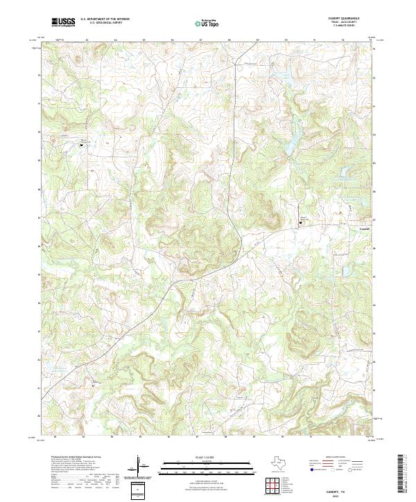
2022 Map of Cundiff
USGS Topo · Published 2022About this map
The settlement of Cundiff sits at the intersection of local routes in this North Texas landscape, where the W Fork Trinity River and its various tributaries carve through the terrain of Jack County. Local genealogy is well-represented by several burial sites, including Burton Springs Cem, Lost Creek Cem, and Howard Valley Cem, providing key points of interest for family historians. The area is defined by its water management and agricultural infrastructure, shown through the various reservoirs of the Soil Conservation Service and named bodies like Worthington Lake Number 1 and Craft Lake. A network of ranch and county roads such as Coca Cola Ranch Rd, Old Bowie Rd, and Durham Ranch Rd connects these rural homesteads and waterways, reflecting the region's enduring cattle and ranching heritage.
Find a feature on this map
29 named features on this map. Tap any name to fly to it.
Don’t see what you’re looking for? This feature index may not catch every label — zoom into the map to look around manually.
Map Details
Editions of this 2022 Cundiff Map
This is the sole edition of this map. No revisions or reprints were ever made.
Other maps of this area

1954 · Sherman
USGS Topo · 1:250,000

1954 · Wichita Falls
USGS Topo · 1:250,000

1958 · Wichita Falls
USGS Topo · 1:250,000

1958 · Sherman
USGS Topo · 1:250,000

1960 · Wizard Wells
USGS Topo · 1:24,000

1960 · Jacksboro
USGS Topo · 1:24,000

1961 · Selma
USGS Topo · 1:24,000

1961 · Jacksboro NE
USGS Topo · 1:24,000

1961 · Crafton
USGS Topo · 1:24,000

1964 · Cundiff
USGS Topo · 1:24,000