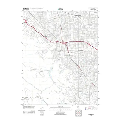
2012 Map of Cupertino
USGS Topo · Published 2012About this map
Cupertino and its surrounding suburban landscape are captured during a period of significant density and established educational institutions. The map shows the concentration of academic centers, including De Anza College and the University of California Santa Clara Extension, alongside residential enclaves like Rancho Rinconada and Blossom Valley. To the south, the terrain shifts into the foothills of Table Mountain, where the land use transitions from dense street grids to more recreational and natural spaces. This area features a string of camps such as Camp Sycamore and Camp Saratoga, and recreational sites like the Saratoga Golf And Country Club. The drainage patterns of Permanente Cr and Stevens Cr underscore the region's geographical orientation between the developed Santa Clara Valley floor and the rising mountains to the west.
Find a feature on this map
50 named features on this map. Tap any name to fly to it.
Don’t see what you’re looking for? This feature index may not catch every label — zoom into the map to look around manually.
Map Details
Editions of this 2012 Cupertino Map
This is the sole edition of this map. No revisions or reprints were ever made.
Other maps of this area

1889 · San Jose
USGS Topo · 1:62,500

1897 · San Jose
USGS Topo · 1:62,500

1897 · Palo Alto
USGS Topo · 1:62,500

1899 · San Jose
USGS Topo · 1:62,500

1899 · Palo Alto
USGS Topo · 1:62,500

1902 · Santa Cruz
USGS Topo · 1:125,000

1916 · New Almaden
USGS Topo · 1:48,000

1919 · New Almaden
USGS Topo · 1:62,500

1940 · Los Gatos
USGS Topo · 1:62,500

1941 · Palo Alto
USGS Topo · 1:62,500