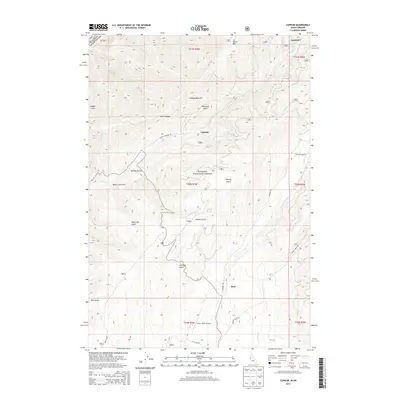
2013 Map of Cuprum
USGS Topo · Published 2013About this map
Cuprum and the nearby settlement of Landore serve as the primary human touchpoints in this pocket of the Payette National Forest during the early 21st century. The landscape is defined by a dense network of watercourses and topographical landmarks, including Horse Mtn and Lynes Saddle. Transportation through this corner of Adams County relies on corridors like Council Cuprum Rd and Landore Rd, which connect the isolated mountain communities. The mapping reveals a transition from higher elevations near Hathaway Gulch down toward the aviation access provided by the Seven Devils Airport. Smaller geographic features such as Stockade Spring and Negro Bill Gulch indicate a legacy of local naming that persists alongside larger drainage systems like Bear Cr and Indian Cr.
Find a feature on this map
44 named features on this map. Tap any name to fly to it.
Don’t see what you’re looking for? This feature index may not catch every label — zoom into the map to look around manually.
Map Details
Editions of this 2013 Cuprum Map
This is the sole edition of this map. No revisions or reprints were ever made.
Other maps of this area

1920 · Seven Devils Mining District
USGS Topo · 1:48,000

1955 · Baker
USGS Topo · 1:250,000

1955 · Grangeville
USGS Topo · 1:250,000

1957 · Cuprum
USGS Topo · 1:62,500

1957 · Homestead
USGS Topo · 1:62,500

1957 · Copperfield
USGS Topo · 1:62,500

1957 · Hornet
USGS Topo · 1:62,500

1959 · Baker
USGS Topo · 1:250,000

1959 · Grangeville
USGS Topo · 1:250,000

1980 · McCall
USGS Topo · 1:100,000