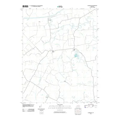
2010 Map of Curdsville
USGS Topo · Published 2010About this map
The Green River meanders along the northern edge of this McLean County landscape, where the settlement of Curdsville sits near its banks. This region is defined by a dense network of waterways, including the winding Panther Creek and the various branches of Knoblick Creek, such as the Middle Fork Knoblick Creek and West Fork Knoblick Creek. These streams create a complex drainage pattern that historically dictated the placement of roads and farmsteads.
Find a feature on this map
54 named features on this map. Tap any name to fly to it.
Don’t see what you’re looking for? This feature index may not catch every label — zoom into the map to look around manually.
Map Details
Editions of this 2010 Curdsville Map
This is the sole edition of this map. No revisions or reprints were ever made.
Other maps of this area

1901 · Owensboro
USGS Topo · 1:62,500

1905 · Newburg
USGS Topo · 1:62,500

1906 · Sutherland
USGS Topo · 1:62,500

1908 · Calhoun
USGS Topo · 1:62,500

1951 · Spottsville
USGS Topo · 1:24,000

1952 · Owensboro West
USGS Topo · 1:24,000

1952 · Reed
USGS Topo · 1:24,000

1952 · Calhoun
USGS Topo · 1:24,000

1952 · Beech Grove
USGS Topo · 1:24,000
1953 · Glenville
USGS Topo · 1:24,000