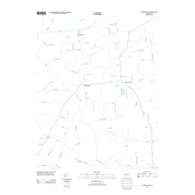
2013 Map of Curdsville
USGS Topo · Published 2013About this map
The Green River flows along the northern edge of this landscape, anchoring the riverfront community of Curdsville. This region is defined by an intricate network of waterways, primarily the various branches of Knoblick Cr, including its West, Middle, and East forks. These creeks carve through the terrain, shaping the agricultural layout of small settlements like Saint Joseph and Elba. In the southern portion of the map, Wyman Lake serves as a local landmark near the community of Wyman.
Find a feature on this map
72 named features on this map. Tap any name to fly to it.
Don’t see what you’re looking for? This feature index may not catch every label — zoom into the map to look around manually.
Map Details
Editions of this 2013 Curdsville Map
This is the sole edition of this map. No revisions or reprints were ever made.
Other maps of this area

1901 · Owensboro
USGS Topo · 1:62,500

1905 · Newburg
USGS Topo · 1:62,500

1906 · Sutherland
USGS Topo · 1:62,500

1908 · Calhoun
USGS Topo · 1:62,500

1951 · Spottsville
USGS Topo · 1:24,000

1952 · Owensboro West
USGS Topo · 1:24,000

1952 · Reed
USGS Topo · 1:24,000

1952 · Calhoun
USGS Topo · 1:24,000

1952 · Beech Grove
USGS Topo · 1:24,000
1953 · Glenville
USGS Topo · 1:24,000