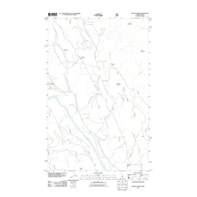
2011 Map of Curley Creek
USGS Topo · Published 2011About this map
The Kootenai River carves through this borderland region between Idaho and Montana, dictating the local transport network and drainage patterns. Rural infrastructure is anchored by essential public services, including the Curley Creek Vol Fire Dept and its Station 2, alongside the McCormick Vol Fire Dept to the south. The landscape is defined by significant elevations such as Murphy Mountain, Haystack Mountain, and Leonia Knob, which overlook a complex system of creeks like Sand Creek and Curley Creek.
Find a feature on this map
39 named features on this map. Tap any name to fly to it.
Don’t see what you’re looking for? This feature index may not catch every label — zoom into the map to look around manually.
Map Details
Editions of this 2011 Curley Creek Map
This is the sole edition of this map. No revisions or reprints were ever made.
Other maps of this area

1911 · Priest Lake
USGS Topo · 1:250,000

1913 · Priest Lake
USGS Topo · 1:250,000

1957 · Kalispell
USGS Topo · 1:250,000

1958 · Sandpoint
USGS Topo · 1:250,000

1960 · Kalispell
USGS Topo · 1:250,000

1961 · Kalispell
USGS Topo · 1:250,000

1963 · Sandpoint
USGS Topo · 1:250,000

1963 · Mount Baldy
USGS Topo · 1:24,000
1963 · Newton Mountain
USGS Topo · 1:24,000
1963 · Kilbrennan Lake
USGS Topo · 1:24,000