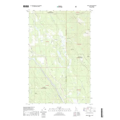
2020 Map of Curley Creek
USGS Topo · Published 2020About this map
Kootenai National Forest and Kaniksu National Forest dominate this borderland where the Idaho panhandle meets Montana's high country. The landscape is defined by the sharp descent of the Cabinet Mountains and Purcell Mountains toward the winding Kootenai River. This 2020 survey documents the complex interface between protected wilderness and rural access, featuring an intricate network of forest development roads such as Old Hwy Two Lp and Columbia Ln.
Find a feature on this map
59 named features on this map. Tap any name to fly to it.
Don’t see what you’re looking for? This feature index may not catch every label — zoom into the map to look around manually.
Map Details
Editions of this 2020 Curley Creek Map
This is the sole edition of this map. No revisions or reprints were ever made.
Other maps of this area

1911 · Priest Lake
USGS Topo · 1:250,000

1913 · Priest Lake
USGS Topo · 1:250,000

1957 · Kalispell
USGS Topo · 1:250,000

1958 · Sandpoint
USGS Topo · 1:250,000

1960 · Kalispell
USGS Topo · 1:250,000

1961 · Kalispell
USGS Topo · 1:250,000

1963 · Sandpoint
USGS Topo · 1:250,000

1963 · Mount Baldy
USGS Topo · 1:24,000
1963 · Newton Mountain
USGS Topo · 1:24,000
1963 · Kilbrennan Lake
USGS Topo · 1:24,000