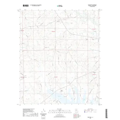
2020 Map of Curr Creek
USGS Topo · Published 2020About this map
Caney Creek Reservoir dominates the southern landscape of this Jackson Parish region, where the wooded hills of North Louisiana meet a network of small creeks and drainages. The area is defined by its rural cemeteries and church sites, many of which carry the names of long-established families and congregations, such as Ebenezer Baptist Church Cem and Collier / New Hope Cem. A complex drainage system feeds into the Little Dugdemona River, including Curr Cr, Hancock Cr, and Edwards Br.
Find a feature on this map
77 named features on this map. Tap any name to fly to it.
Don’t see what you’re looking for? This feature index may not catch every label — zoom into the map to look around manually.
Map Details
Editions of this 2020 Curr Creek Map
This is the sole edition of this map. No revisions or reprints were ever made.
Other maps of this area

1949 · Jonesboro
USGS Topo · 1:62,500

1950 · Jonesboro
USGS Topo · 1:62,500

1953 · Chatham
USGS Topo · 1:62,500

1953 · Hodge
USGS Topo · 1:62,500

1954 · Sikes
USGS Topo · 1:62,500

1955 · Shreveport
USGS Topo · 1:250,000

1956 · Shreveport
USGS Topo · 1:250,000

1982 · Chatham
USGS Topo · 1:24,000
1982 · Eros
USGS Topo · 1:24,000

1984 · Shreveport
USGS Topo · 1:250,000