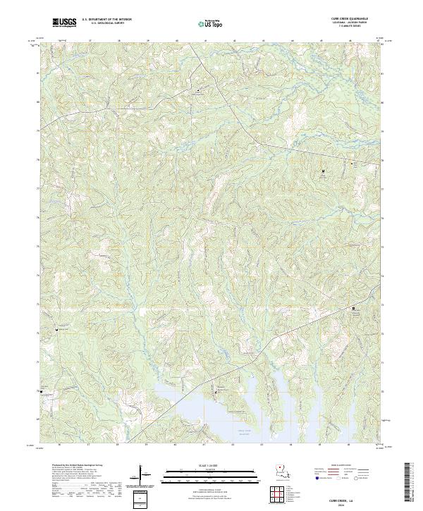
2024 Map of Curr Creek
USGS Topo · Published 2024About this map
Caney Creek Reservoir dominates the southern landscape of this Jackson Parish quadrangle, where the terrain is defined by a dense network of tributaries feeding into the Little Dugdemona River. The area maintains a rural character centered around long-standing community institutions and family burial grounds. Local history is anchored by the Ebenezer Baptist Church and its associated Ebenezer Baptist Church Cem, alongside several other notable sites such as Old Saint Clair Cem and the Collier / New Hope Cem. A complex system of parish roads, including Winnfield Rd and New Hope Rd, connects these remote settlements across a landscape of creeks like Curr Creek, Fourmile Creek, and Hancock Creek. The map provides a clear picture of the modern road network superimposed over traditional parish land divisions.
Find a feature on this map
83 named features on this map. Tap any name to fly to it.
Don’t see what you’re looking for? This feature index may not catch every label — zoom into the map to look around manually.
Map Details
Editions of this 2024 Curr Creek Map
This is the sole edition of this map. No revisions or reprints were ever made.
Other maps of this area

1949 · Jonesboro
USGS Topo · 1:62,500

1950 · Jonesboro
USGS Topo · 1:62,500

1953 · Chatham
USGS Topo · 1:62,500

1953 · Hodge
USGS Topo · 1:62,500

1954 · Sikes
USGS Topo · 1:62,500

1955 · Shreveport
USGS Topo · 1:250,000

1956 · Shreveport
USGS Topo · 1:250,000

1982 · Chatham
USGS Topo · 1:24,000
1982 · Eros
USGS Topo · 1:24,000

1984 · Shreveport
USGS Topo · 1:250,000