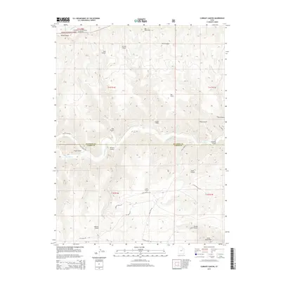
2014 Map of Currant Canyon
USGS Topo · Published 2014About this map
The Bad Land Cliffs dominate the northern landscape of this Duchesne County region, marking a sharp transition in the high desert terrain. This 2014 survey documents a rugged network of drainages and technical infrastructure where industrial energy extraction meets the public lands of the Ashley National Forest. The presence of the Stone Cabin Gas Field and its associated infrastructure, including the Stone Cabin Gas Fld roads, highlights the modern economic character of the basin.
Find a feature on this map
33 named features on this map. Tap any name to fly to it.
Don’t see what you’re looking for? This feature index may not catch every label — zoom into the map to look around manually.
Map Details
Editions of this 2014 Currant Canyon Map
This is the sole edition of this map. No revisions or reprints were ever made.
Other maps of this area

1886 · Price River
USGS Topo · 1:250,000

1896 · Price River
USGS Topo · 1:250,000

1915 · Sunnyside
USGS Topo · 1:62,500

1954 · Flat Canyon
USGS Topo · 1:62,500

1956 · Price
USGS Topo · 1:250,000

1960 · Price
USGS Topo · 1:250,000

1962 · Price
USGS Topo · 1:250,000
1968 · Anthro Mtn NE
USGS Topo · 1:24,000

1968 · Wood Canyon
USGS Topo · 1:24,000
1968 · Cowboy Bench
USGS Topo · 1:24,000