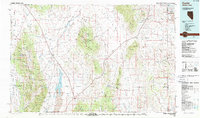
1987 Map of Currie
USGS Topo · Published 1987About this map
Currie serves as a lone settlement hub along the Nevada Northern railroad line in this 1987 survey of the high desert basin. The landscape is dominated by the broad expanse of Steptoe Valley and Goshute Valley, where the waters of Goshute Lake rest near the base of the Dolly Varden Mountains. This era shows a region defined by its wide internal drainages and isolated mountain ranges, including the Cherry Creek Range and Kinsley Mountains. Evidence of the region's ranching and transit history is found in the network of remote water sources like Boone Spring and Ferguson Spring. To the east, the map captures the transition into the Wendover Air Force Range and the Goshute Indian Reservation, illustrating the intersection of military, indigenous, and industrial land use in the Great Basin.
Find a feature on this map
37 named features on this map. Tap any name to fly to it.
Don’t see what you’re looking for? This feature index may not catch every label — zoom into the map to look around manually.
Map Details
Editions of this 1987 Currie Map
This is the sole edition of this map. No revisions or reprints were ever made.
Other maps of this area

1908 · Fish Springs
USGS Topo · 1:250,000

1910 · Fish Springs
USGS Topo · 1:250,000

1925 · Gold Hill
USGS Topo · 1:62,500

1928 · Gold Hill
USGS Topo · 1:62,500

1935 · Halleck
USGS Topo · 1:125,000

1953 · Spruce Mountain
USGS Topo · 1:62,500

1953 · Spruce Mountain 4
USGS Topo · 1:62,500

1953 · Tooele
USGS Topo · 1:250,000

1953 · Delta
USGS Topo · 1:250,000

1955 · Tooele
USGS Topo · 1:250,000