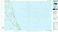
1985 Map of Currituck Sound
USGS Topo · Published 1985About this map
The Wright Brothers National Memorial anchors the southern reaches of this maritime landscape, where the barrier islands of the Outer Banks meet the expansive waters of the Atlantic Ocean. This mid-1980s planimetric study details the intricate coastal geography of the Currituck Sound, a region defined by its numerous bays, islands, and landings. To the north, the Mackay Island National Wildlife Refuge and Knotts Island mark the boundary with Virginia, while the mainland side features rural settlements like Coinjock and Poplar Branch Landing. The barrier spit is sparsely populated, with the Currituck Beach Lighthouse standing near Corolla, and the growing communities of Duck and Kitty Hawk appearing to the south. This era shows the region before the most intensive modern development, preserving the footprints of older landings such as Knotts Landing and Newbern Landing along the sound side.
Find a feature on this map
89 named features on this map. Tap any name to fly to it.
Don’t see what you’re looking for? This feature index may not catch every label — zoom into the map to look around manually.
Map Details
Editions of this 1985 Currituck Sound Map
2 editions found
Other maps of this area

1893 · Virginia Beach
USGS Topo · 1:125,000

1916 · Back Bay
USGS Topo · 1:62,500

1939 · Moyock
USGS Topo · 1:62,500

1940 · Barco
USGS Topo · 1:62,500

1940 · Kitty Hawk
USGS Topo · 1:62,500

1940 · Powells Point
USGS Topo · 1:62,500

1940 · Wade Point
USGS Topo · 1:62,500

1943 · Wade Point
USGS Topo · 1:62,500

1943 · Columbia
USGS Topo · 1:125,000

1943 · Back Bay
USGS Topo · 1:62,500