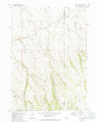
1980 Map of Curtis Draw
USGS Topo · Published 1986About this map
Devil Creek Ranch and Stanley Cabin anchor this high-desert landscape where the borders of Owyhee and Twin Falls counties in Idaho meet the Nevada state line. This 1980s-era survey reveals a remote ranching environment defined by essential water sources and seasonal drainages. Strategic landmarks like the Guerry Corral and various unnamed corrals and wells indicate a livestock-centered economy, while terrain features like The Trap and Mud Flat Hill illustrate the complex topography of the high plains. A network of jeep trails provides the primary access through the drainage basins of West Fork Devil Creek, Little House Creek, and Deer Creek. This map preserves the locations of early 20th-century improvements in a transition zone between the high desert and the Owyhee Mountains, marked by numerous named springs such as Whiteside Spring and Pinkston Spring.
Find a feature on this map
33 named features on this map. Tap any name to fly to it.
Don’t see what you’re looking for? This feature index may not catch every label — zoom into the map to look around manually.
Map Details
Editions of this 1980 Curtis Draw Map
2 editions found
Other maps of this area

1955 · Twin Falls
USGS Topo · 1:250,000

1955 · Wells
USGS Topo · 1:250,000

1957 · Contact
USGS Topo · 1:62,500

1957 · Elk Mountain
USGS Topo · 1:62,500

1958 · Wells
USGS Topo · 1:250,000

1958 · Twin Falls
USGS Topo · 1:250,000

1961 · Wells
USGS Topo · 1:250,000

1977 · Cedar Creek Reservoir
USGS Topo · 1:24,000

1978 · Taylor Canyon
USGS Topo · 1:24,000

1979 · Salls Crossing
USGS Topo · 1:24,000