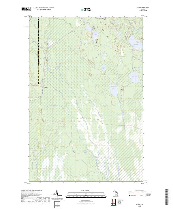
2023 Map of Cusino
USGS Topo · Published 2023About this map
Cusino sits within a landscape defined by an intricate network of wetlands and small glacial lakes near the boundary of Pictured Rocks National Lakeshore. The area is marked by the transition from the upland terrain of Alger and Schoolcraft counties, where the headwaters of the Creighton River and Marsh Creek begin their slow descent through the Creighton Marsh. This 2023 survey illustrates a wilderness primarily accessible via a system of truck trails and forest roads, including the Twin Lake Truck Trl and Wolf Lake Rd. The map detail shows how water dominates the geography, from the cluster of Gemini Lakes in the north to the isolated basins of Cusino Lake and Worchester Lake in the east. The presence of the Gemini Lakes Pathway Trl suggests a region dedicated to conservation and low-impact recreation within the vast Michigan backwoods.
Find a feature on this map
37 named features on this map. Tap any name to fly to it.
Don’t see what you’re looking for? This feature index may not catch every label — zoom into the map to look around manually.
Map Details
Editions of this 2023 Cusino Map
This is the sole edition of this map. No revisions or reprints were ever made.
Other maps of this area

1931 · Shingleton SW
USGS Topo · 1:31,680

1931 · Shingleton NE
USGS Topo · 1:31,680

1931 · Driggs Lake NW
USGS Topo · 1:31,680

1931 · Shingleton SE
USGS Topo · 1:31,680

1931 · Driggs Lake SW
USGS Topo · 1:31,680

1958 · Shingleton
USGS Topo · 1:62,500

1958 · Grand Portal Point
USGS Topo · 1:62,500

1958 · Marquette
USGS Topo · 1:250,000

1960 · Marquette
USGS Topo · 1:250,000

1961 · Marquette
USGS Topo · 1:250,000