
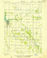
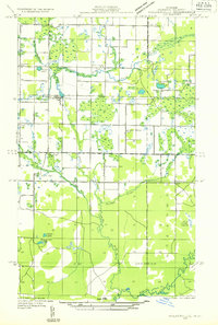
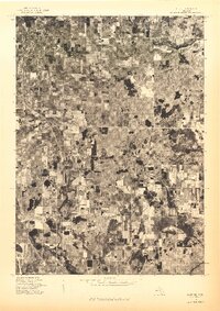
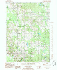
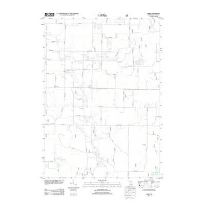
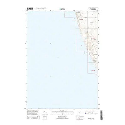
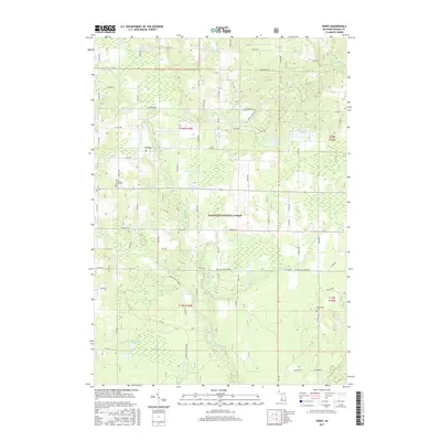
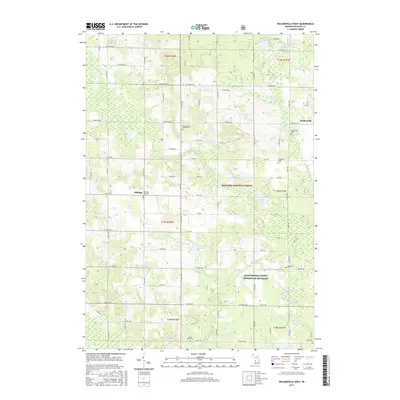
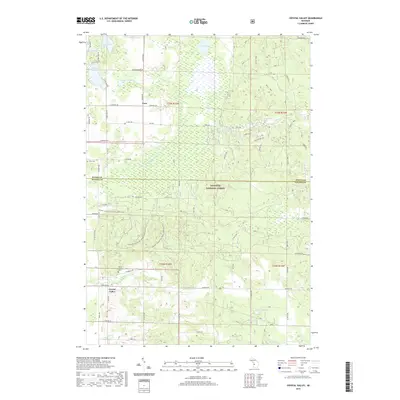
1931 Map of Custer SE
USGS Topo · Published 1931About this map
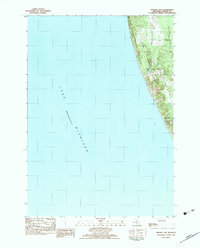
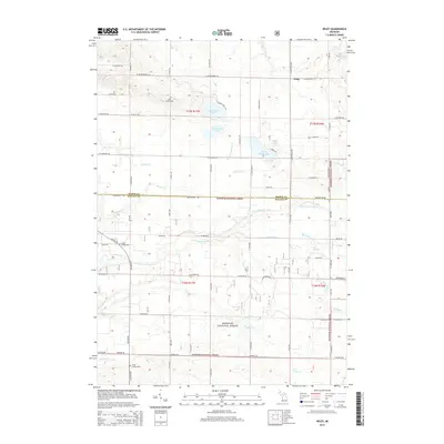
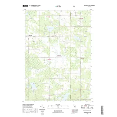
South Branch Pere Marquette River meanders through this section of Western Michigan, cutting through a landscape defined by its rural schoolhouses and marshy wetlands in the early 1930s. The map captures a moment when the intersection of Mason, Lake, Oceana, and Newaygo counties was dotted with local institutions like Ruby Sch, Lockes Sch, and Waddell Sch. These small rural schools served the surrounding farmsteads located near Carr Creek and the headwaters of Ruby Creek. The terrain is characterized by numerous small bodies of water and wetlands, including School Section Lake, Augustine Lake, and the aptly named Darkeys Marsh. The detailed surveying by the Geological Survey Division reflects the remote character of Colfax and Logan townships before modern infrastructure reshaped the local drainage and road networks.
Find a feature on this map
21 named features on this map. Tap any name to fly to it.
Don’t see what you’re looking for? This feature index may not catch every label — zoom into the map to look around manually.
Map Details
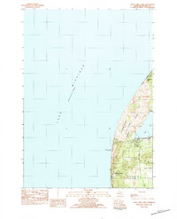
Editions of this 1931 Custer SE Map
This is the sole edition of this map. No revisions or reprints were ever made.
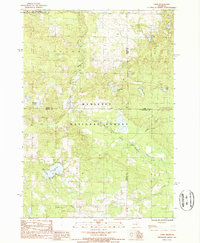
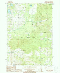
Historical Maps of Carr Through Time
74 maps found
1931 Custer SE
Oceana County, MI

1931 Custer SW
Oceana County, MI
1931 Hart NE
Oceana County, MI
1931 Hart NW
Oceana County, MI
1931 Hart SE
Oceana County, MI

1931 Walkerville NE
Oceana County, MI
1931 Walkerville NW
Oceana County, MI

1931 Walkerville SE
Oceana County, MI
1931 Walkerville SW
Oceana County, MI

1932 Ludington SE
Oceana County, MI

1932 Ludington SW
Oceana County, MI

1976 Custer SE
Oceana County, MI
1976 Custer SW
Oceana County, MI
1976 Hart NE
Oceana County, MI
1976 Hart NW
Oceana County, MI
1976 Hart SE
Oceana County, MI

1976 Hersperia NE
Oceana County, MI
1976 Hersperia NW
Oceana County, MI
1976 Hersperia SE
Oceana County, MI
1976 Hersperia SW
Oceana County, MI
1983 Bigsbie Lake
Oceana County, MI
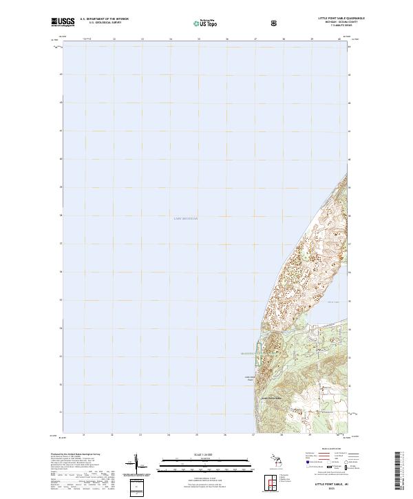
1983 Little Point Sable
Oceana County, MI

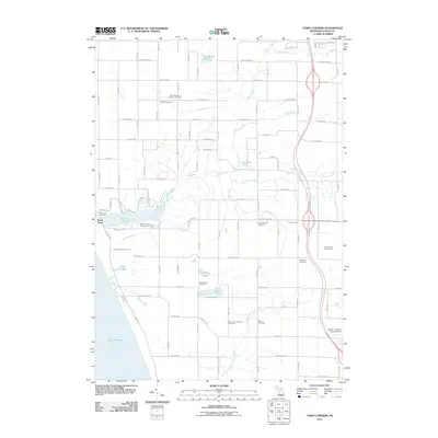
1983 Town Corners
Oceana County, MI
1983 Wiley
Oceana County, MI
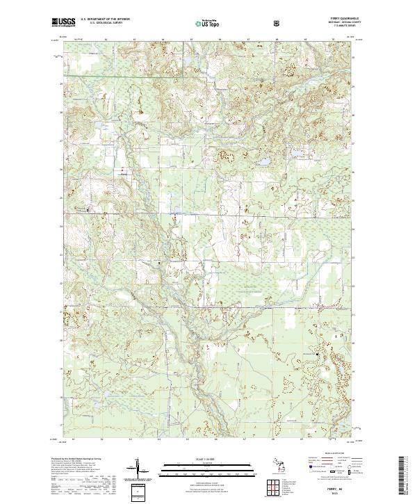
1985 Ferry
Oceana County, MI

1985 Walkerville East
Oceana County, MI
1985 Walkerville West
Oceana County, MI
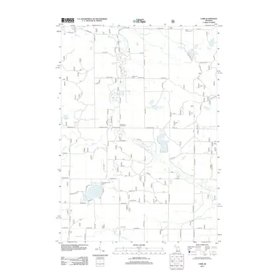
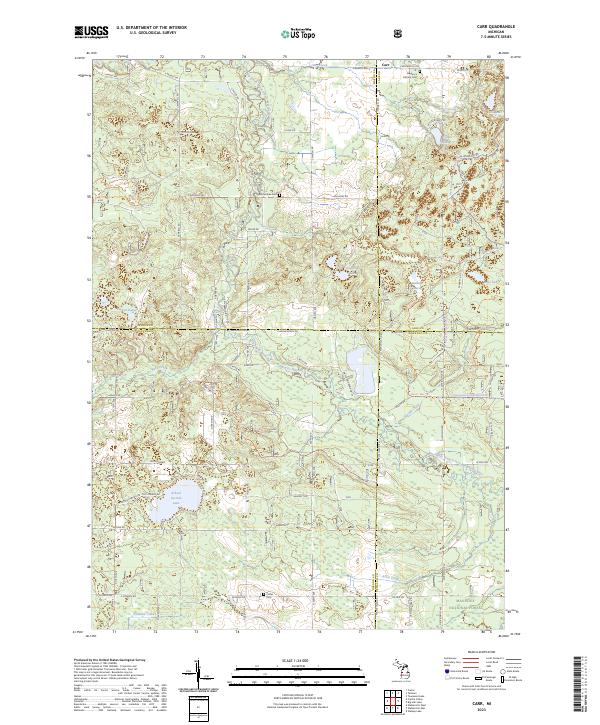
1987 Carr
Oceana County, MI
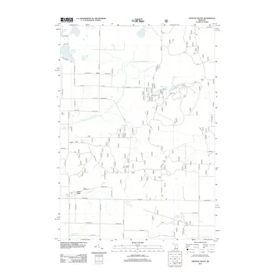
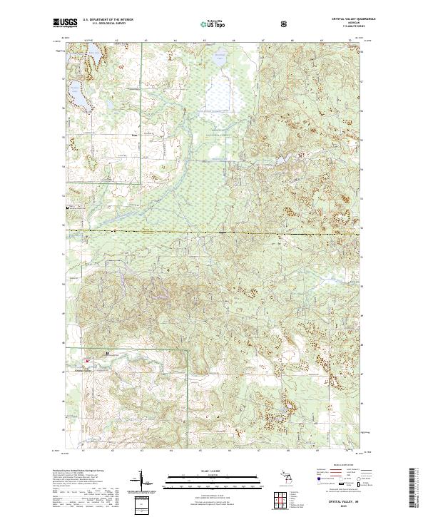
1987 Crystal Valley
Oceana County, MI
2011 Bigsbie Lake
Oceana County, MI
2011 Little Point Sable
Oceana County, MI
2011 Town Corners
Oceana County, MI
2012 Carr
Oceana County, MI
2012 Crystal Valley
Oceana County, MI
2012 Ferry
Oceana County, MI
2012 Walkerville East
Oceana County, MI
2012 Walkerville West
Oceana County, MI
2012 Wiley
Oceana County, MI
2014 Bigsbie Lake
Oceana County, MI
2014 Carr
Oceana County, MI
2014 Crystal Valley
Oceana County, MI
2014 Ferry
Oceana County, MI
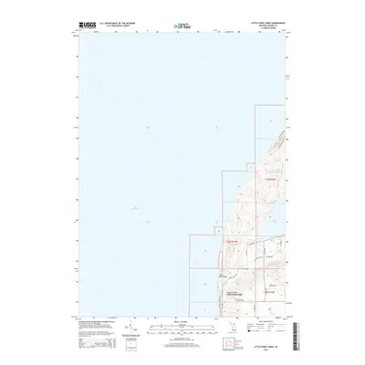
2014 Little Point Sable
Oceana County, MI
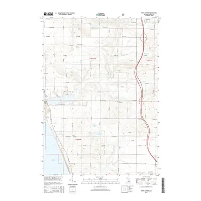
2014 Town Corners
Oceana County, MI
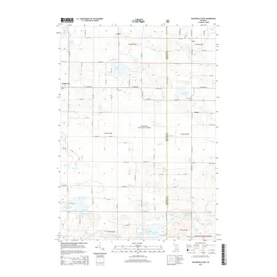
2014 Walkerville East
Oceana County, MI
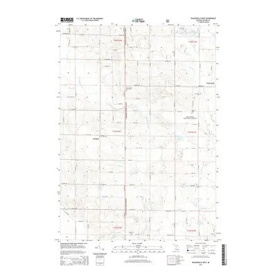
2014 Walkerville West
Oceana County, MI
2014 Wiley
Oceana County, MI
2017 Bigsbie Lake
Oceana County, MI
2017 Carr
Oceana County, MI
2017 Crystal Valley
Oceana County, MI
2017 Ferry
Oceana County, MI
2017 Little Point Sable
Oceana County, MI
2017 Town Corners
Oceana County, MI
2017 Walkerville East
Oceana County, MI
2017 Walkerville West
Oceana County, MI
2017 Wiley
Oceana County, MI
2019 Bigsbie Lake
Oceana County, MI
2019 Carr
Oceana County, MI
2019 Crystal Valley
Oceana County, MI
2019 Ferry
Oceana County, MI
2019 Little Point Sable
Oceana County, MI
2019 Town Corners
Oceana County, MI
2019 Walkerville East
Oceana County, MI
2019 Walkerville West
Oceana County, MI
2019 Wiley
Oceana County, MI
2023 Bigsbie Lake
Oceana County, MI
2023 Carr
Oceana County, MI
2023 Crystal Valley
Oceana County, MI
2023 Ferry
Oceana County, MI
2023 Little Point Sable
Oceana County, MI
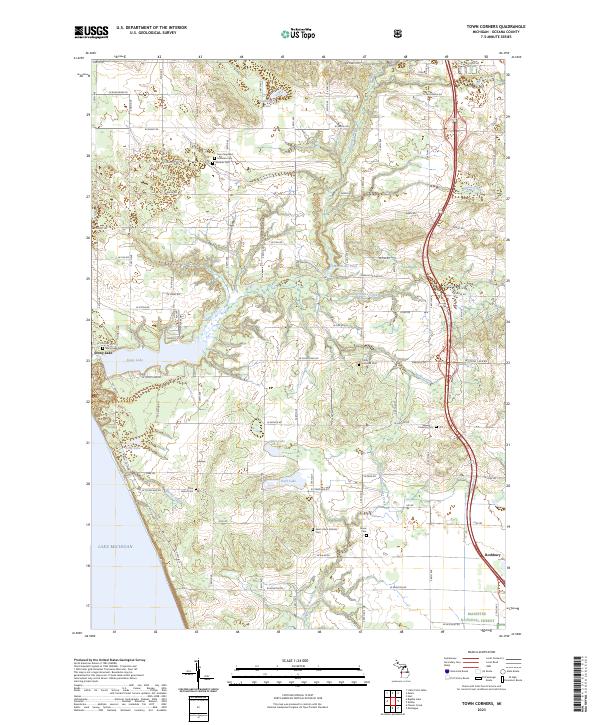
2023 Town Corners
Oceana County, MI
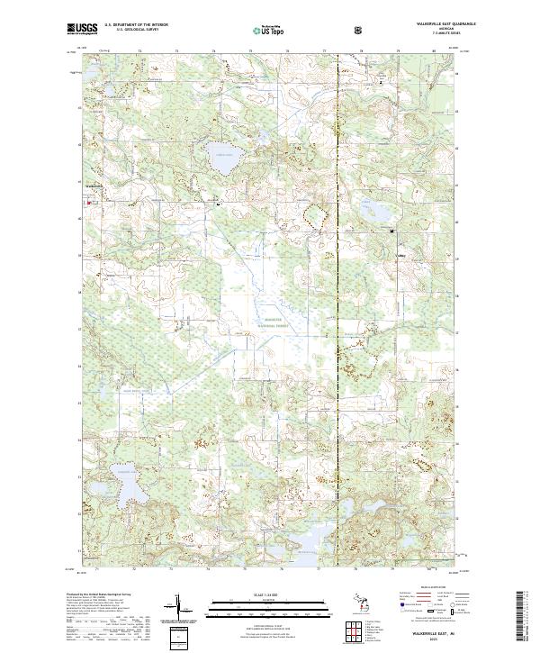
2023 Walkerville East
Oceana County, MI
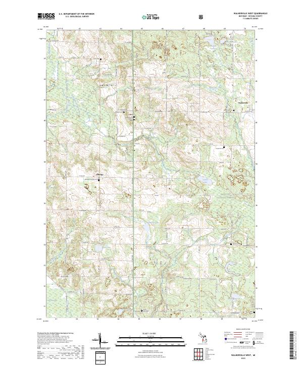
2023 Walkerville West
Oceana County, MI
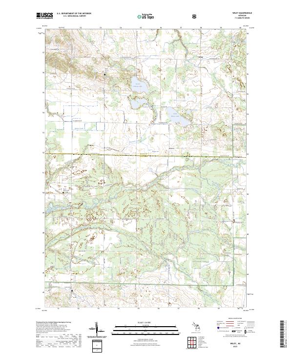
2023 Wiley
Oceana County, MI