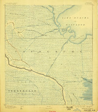
1892 Map of Cut-Off
USGS Topo · Published 1898About this map
Bayou Lafourche serves as the primary artery through this coastal landscape, where the interplay of natural waterways and early navigation improvements is clearly visible. Small settlements like Lacroix, Harang, and Cut-Off line the banks of the bayou, reflecting a distribution pattern tied closely to the water. The map reveals an extensive network of marshes and prairies, including the Grand Prairie des Allemands and the Trembling Prairie, punctuated by engineered features such as the Company Canal and the State Cut Off Canal. To the east, the large expanse of Lake Ouacha or Salvador meets the marsh at Temple Bay and Catahoula Bay, separated by the Isle of Day. These topographic details record the early infrastructure of the parish before modern flood control and drainage projects significantly altered the hydrology of the Mississippi River delta.
Find a feature on this map
25 named features on this map. Tap any name to fly to it.
Don’t see what you’re looking for? This feature index may not catch every label — zoom into the map to look around manually.
Map Details
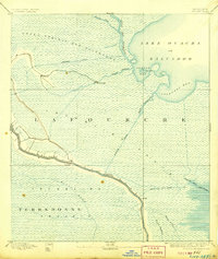
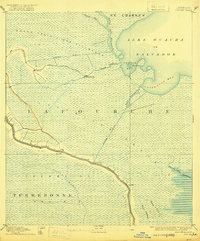
Editions of this 1892 Cut-Off Map
4 editions found
Other maps of this area

1891 · Hahnville
USGS Topo · 1:62,500

1891 · New Orleans
USGS Topo · 1:62,500

1892 · Barataria
USGS Topo · 1:62,500

1892 · Lac Des Allemands
USGS Topo · 1:62,500

1892 · Cut-Off
USGS Topo · 1:62,500

1892 · Houma
USGS Topo · 1:62,500

1892 · Creole
USGS Topo · 1:62,500

1894 · Lake Felicity
USGS Topo · 1:62,500

1894 · Dulac
USGS Topo · 1:62,500

1932 · Houma SE
USGS Topo · 1:31,680