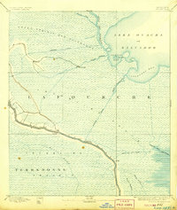
1892 Map of Cut-Off
USGS Topo · Published 1906About this map
Bayou Lafourche serves as the primary artery for settlement and commerce in this late 19th-century survey of the wetlands. Dense residential structures and small plots are concentrated along the banks of the bayou, reflecting the traditional ribbon-lot settlement patterns common to south Louisiana's alluvial ridges. This map reveals a complex hydraulic landscape where natural waterways like Bayou Vacherie and Bayou Catahoula are increasingly integrated with man-made infrastructure, such as the Company Canal and the Harang Canal.
Find a feature on this map
25 named features on this map. Tap any name to fly to it.
Don’t see what you’re looking for? This feature index may not catch every label — zoom into the map to look around manually.
Map Details
Editions of this 1892 Cut-Off Map
4 editions found
Other maps of this area

1891 · Hahnville
USGS Topo · 1:62,500

1891 · New Orleans
USGS Topo · 1:62,500

1892 · Barataria
USGS Topo · 1:62,500

1892 · Lac Des Allemands
USGS Topo · 1:62,500

1892 · Cut-Off
USGS Topo · 1:62,500

1892 · Houma
USGS Topo · 1:62,500

1892 · Creole
USGS Topo · 1:62,500

1894 · Lake Felicity
USGS Topo · 1:62,500

1894 · Dulac
USGS Topo · 1:62,500

1932 · Houma SE
USGS Topo · 1:31,680