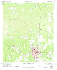
1972 Map of Cuthbert
USGS Topo · Published 1975About this map
Cuthbert serves as the regional hub for Randolph County in the early 1970s, defined by its historic educational and civic core. The campus of Andrew College sits near the town center, while local infrastructure is anchored by the Courthouse, Hospital, and County High Sch. The town is the junction for significant rail corridors, including the Central of Georgia and the Seaboard Coast Line, which intersect near the Sewage Disposal Pond and the Golf Course.
Find a feature on this map
41 named features on this map. Tap any name to fly to it.
Don’t see what you’re looking for? This feature index may not catch every label — zoom into the map to look around manually.
Map Details
Editions of this 1972 Cuthbert Map
This is the sole edition of this map. No revisions or reprints were ever made.
Other maps of this area

1953 · Dothan
USGS Topo · 1:250,000

1954 · Dothan
USGS Topo · 1:250,000

1955 · Dothan
USGS Topo · 1:250,000
1972 · Sanford
USGS Topo · 1:24,000
1972 · Benevolence
USGS Topo · 1:24,000
1972 · County Line
USGS Topo · 1:24,000
1972 · Brooksville
USGS Topo · 1:24,000
1973 · Morris
USGS Topo · 1:24,000

1973 · Martins Crossroads
USGS Topo · 1:24,000
1973 · Coleman
USGS Topo · 1:24,000