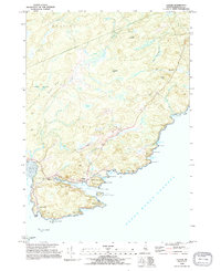
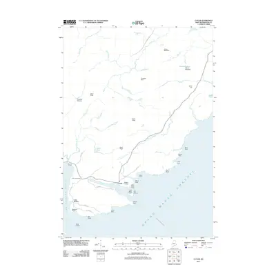
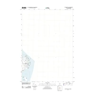
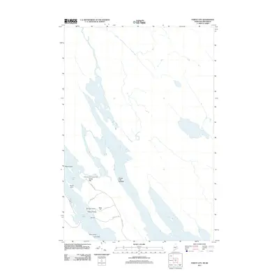
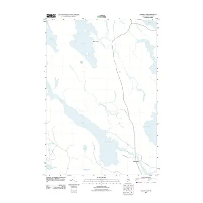
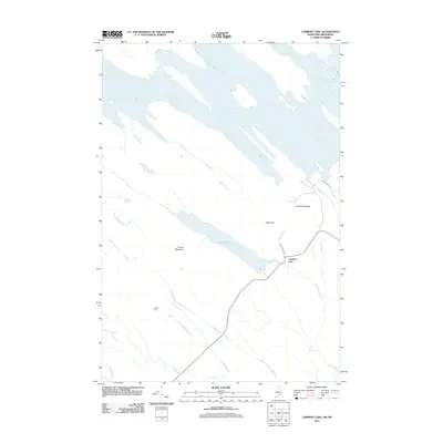
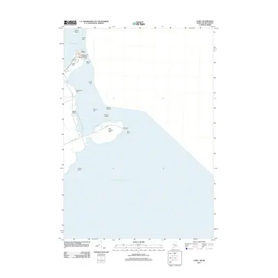
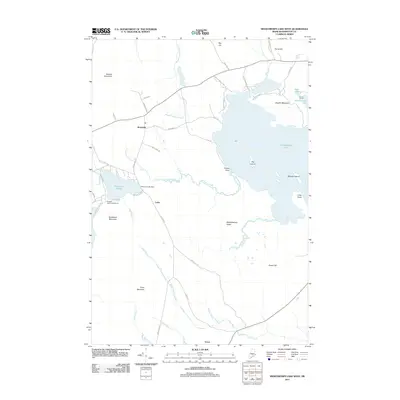
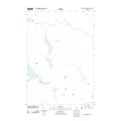
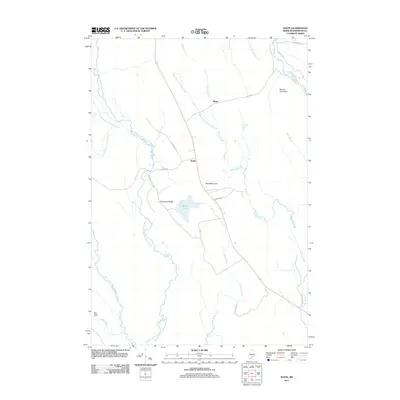
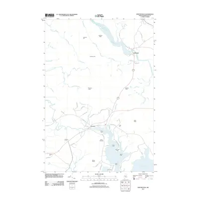
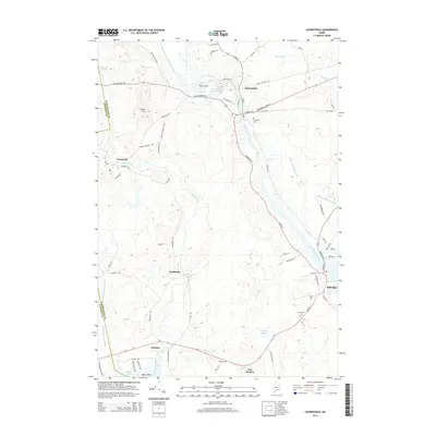
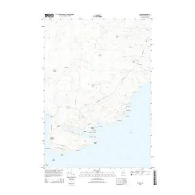
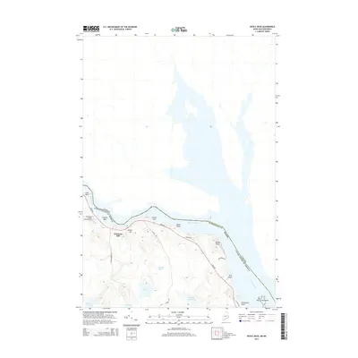
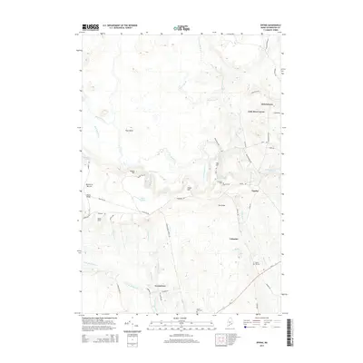
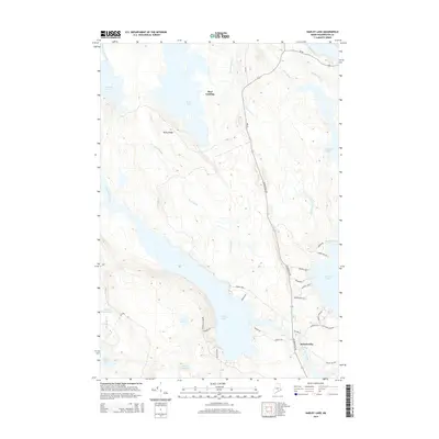
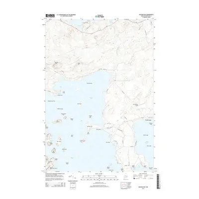
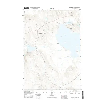
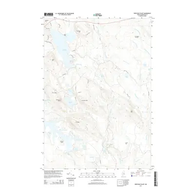
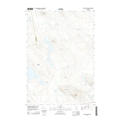
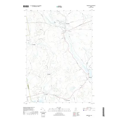
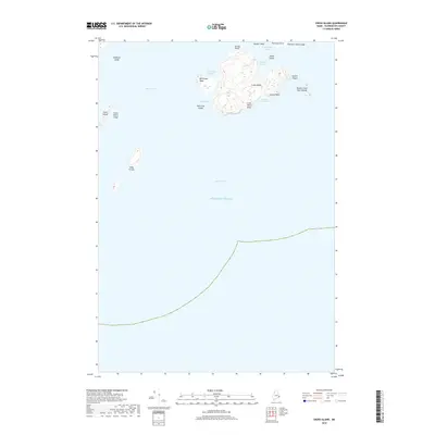
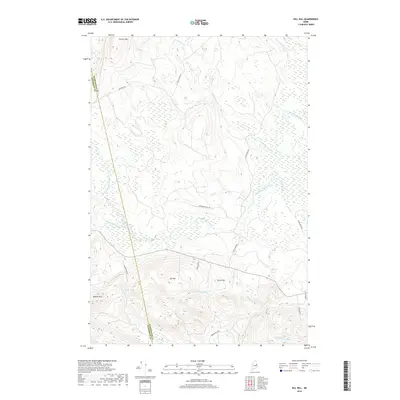
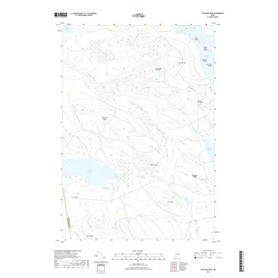
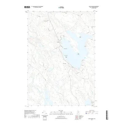
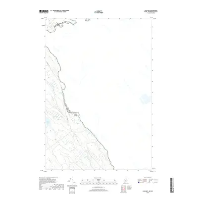
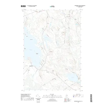
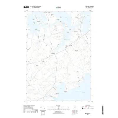
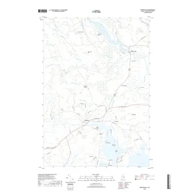
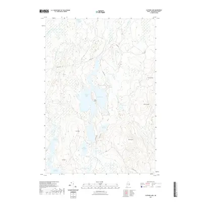
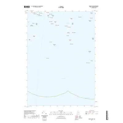
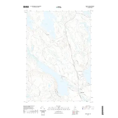
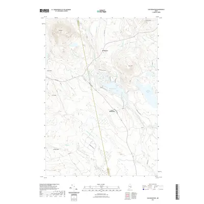
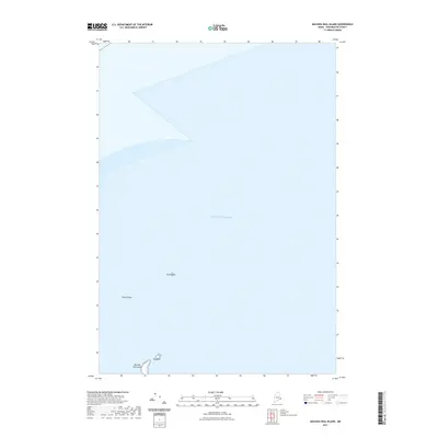
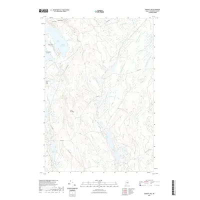
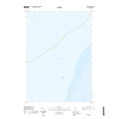
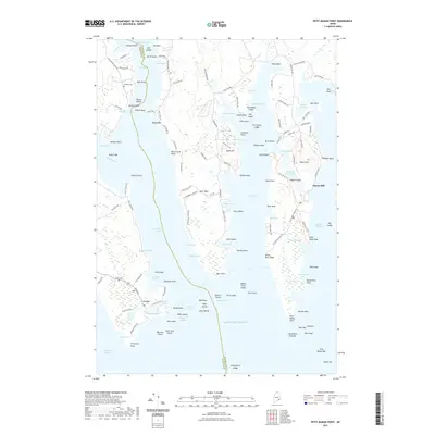
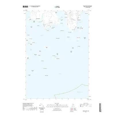
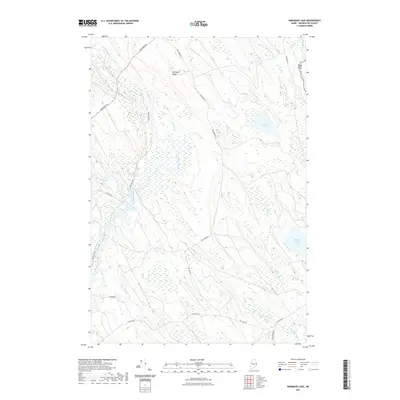
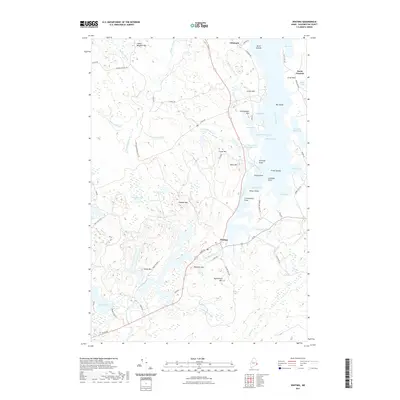
1993 Map of Cutler
USGS Topo · Published 1995About this map
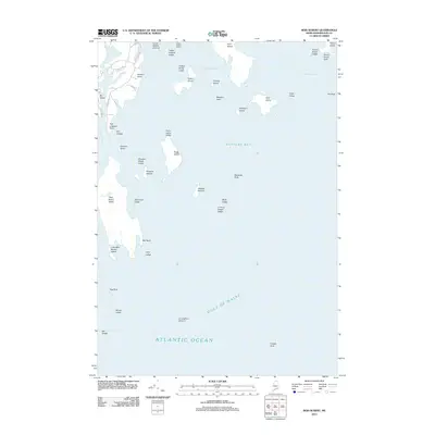
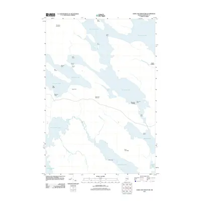
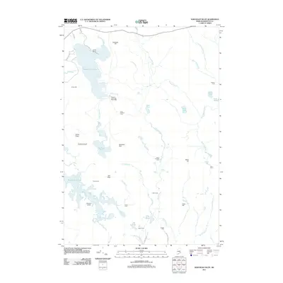
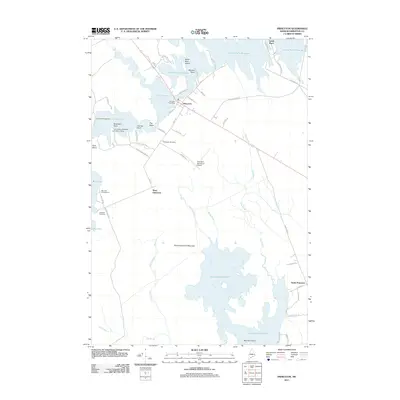
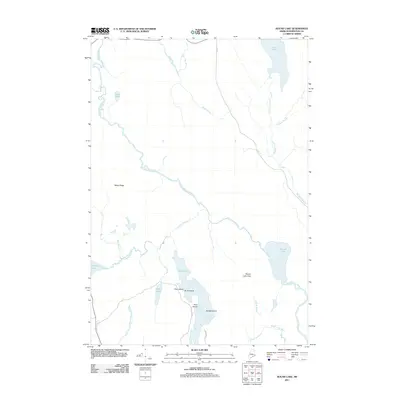
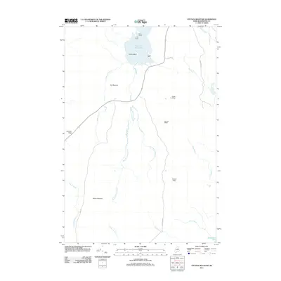
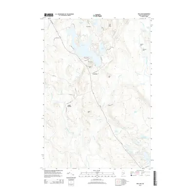
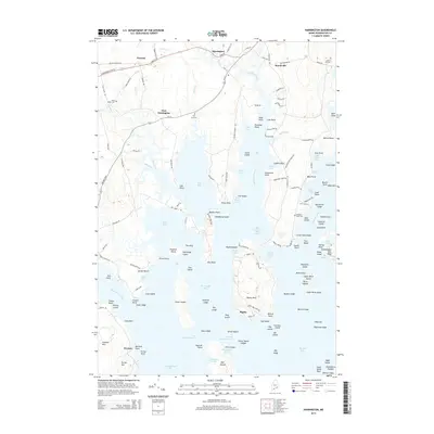
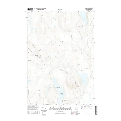
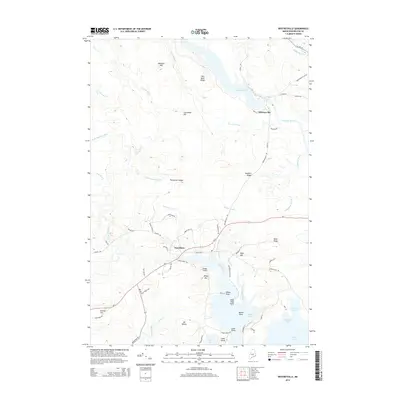
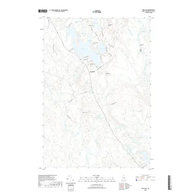
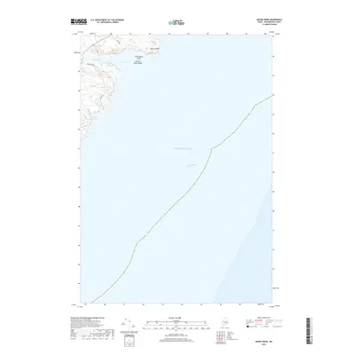
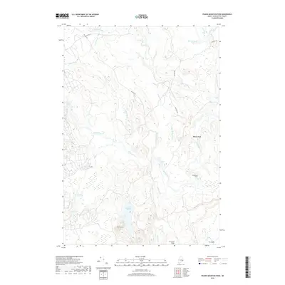
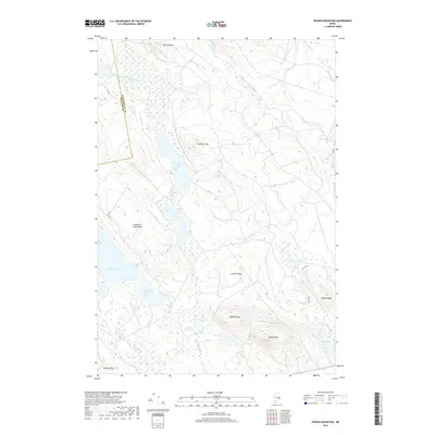
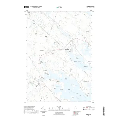
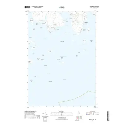
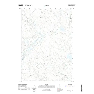
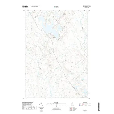
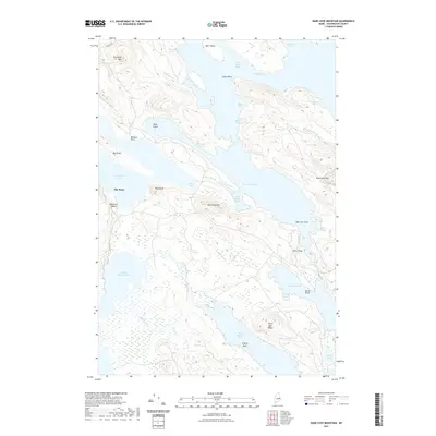
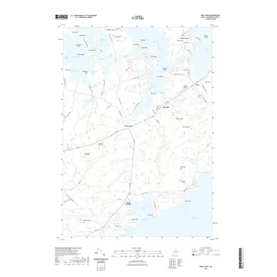
Western Head and the jagged coastline of Washington County define this coastal landscape, where the Grand Manan Channel meets the rocky inlets of Down East Maine. The settlement of Cutler sits protected within Little Harbor, showing a maritime community organized around the water's edge. Local history is anchored by landmarks like the Head of the River Ch, Old Cutler Cem, and a Lighthouse standing watch over Little River Island. Further west, the map details the smaller cluster at Little Machias near the Tidal Flat of Machias Bay. Inland, the terrain rises into ridges such as Pond Ridge and French Ridge, interspersed with wetlands like Harmon Heath and Crotched Meadows. This 1993 field-checked data preserves the location of remote coastal features like Eastern Knubble and Fairy Head before the turn of the millennium.
Find a feature on this map
61 named features on this map. Tap any name to fly to it.
Don’t see what you’re looking for? This feature index may not catch every label — zoom into the map to look around manually.
Map Details
Editions of this 1993 Cutler Map
2 editions found
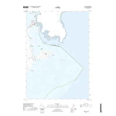
Historical Maps of Cutler Through Time
480 maps found

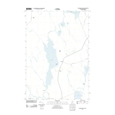
1902 Cherryfield
Washington County, ME

1904 Cherryfield
Washington County, ME

1904 Petit Manan
Washington County, ME

1917 Cutler
Washington County, ME

1918 Cutler
Washington County, ME

1918 Machias
Washington County, ME

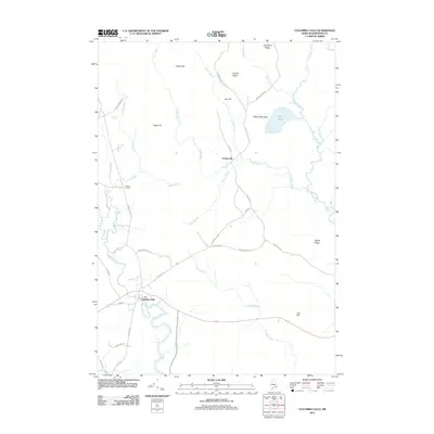
1921 Columbia Falls
Washington County, ME

1921 Columbia Falls
Washington County, ME

1921 Great Wass Island
Washington County, ME

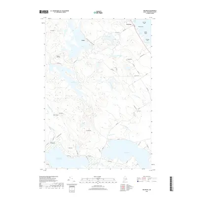
1929 Robbinston
Washington County, ME

1931 Robbinston
Washington County, ME

1940 Forest
Washington County, ME

1940 Kellyland
Washington County, ME

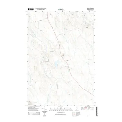
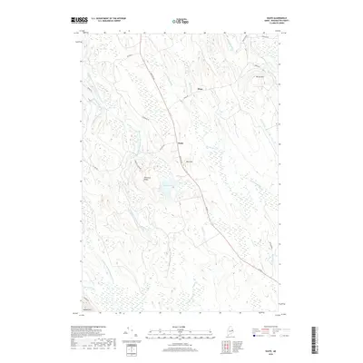
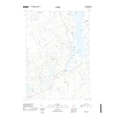
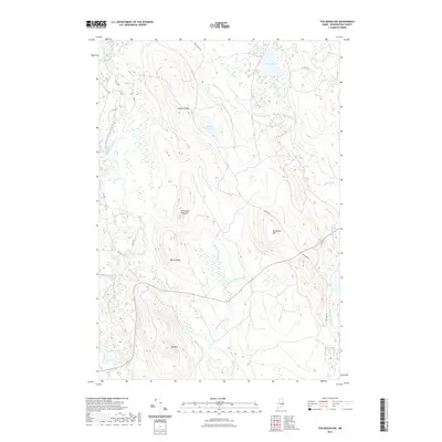
1940 Waite
Washington County, ME

1941 Big Lake
Washington County, ME

1941 Columbia Falls
Washington County, ME

1941 Gardner Lake
Washington County, ME

1941 Machias
Washington County, ME

1941 Scraggly Lake
Washington County, ME

1941 Tug Mountain
Washington County, ME

1941 Wabassus Lake
Washington County, ME

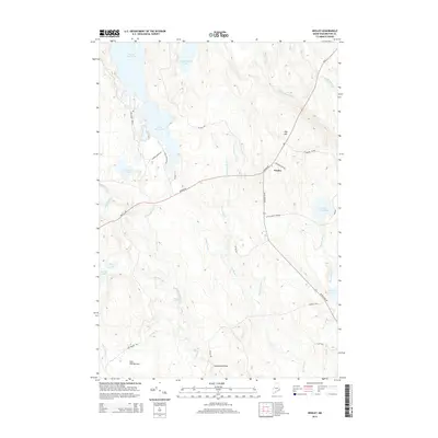
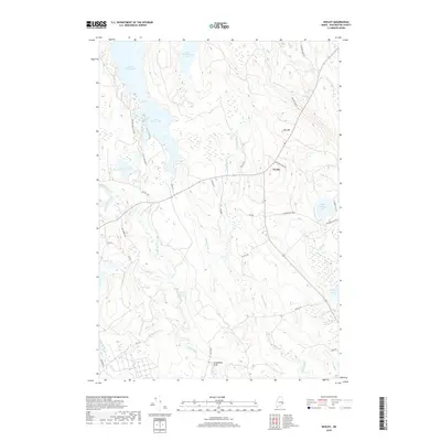
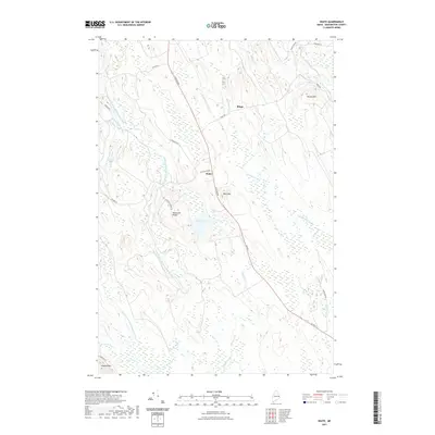
1941 Wesley
Washington County, ME

1942 Cherryfield
Washington County, ME

1942 Columbia Falls
Washington County, ME

1942 Forest
Washington County, ME

1942 Kellyland
Washington County, ME

1942 Waite
Washington County, ME

1943 Big Lake
Washington County, ME

1943 Gardner Lake
Washington County, ME

1943 Tug Mountain
Washington County, ME

1943 Wabassus Lake
Washington County, ME

1943 Wesley
Washington County, ME

1944 Scraggly Lake
Washington County, ME

1948 Addison
Washington County, ME

1948 Cherryfield
Washington County, ME

1948 Columbia Falls
Washington County, ME

1948 Drisko Island
Washington County, ME

1948 Harrington
Washington County, ME

1948 Petit Manan Point
Washington County, ME

1948 Roque Bluffs
Washington County, ME

1948 Whitneyville
Washington County, ME

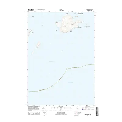
1949 Cross Island
Washington County, ME

1949 Cutler
Washington County, ME

1949 Devils Head
Washington County, ME

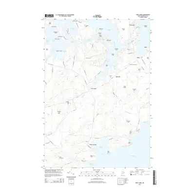
1949 Lubec
Washington County, ME

1949 Machias Bay
Washington County, ME

1949 Machias
Washington County, ME

1949 Moose River
Washington County, ME

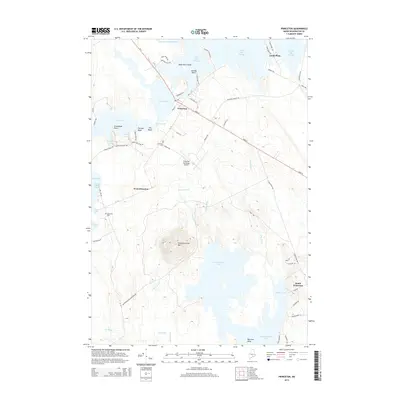
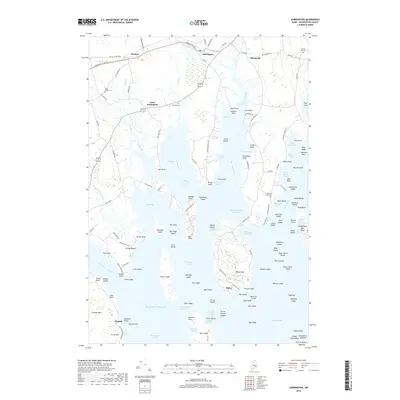
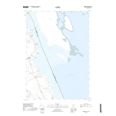
1949 Pembroke
Washington County, ME

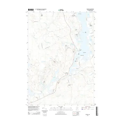
1949 Red Beach
Washington County, ME

1949 Robbinston
Washington County, ME

1949 West Lubec
Washington County, ME

1949 Whiting
Washington County, ME

1950 Bois Bubert
Washington County, ME

1950 Cherryfield
Washington County, ME

1950 Cross Island
Washington County, ME

1950 Drisko Island
Washington County, ME

1950 Great Wass Island
Washington County, ME

1950 Petit Manan
Washington County, ME

1950 Petit Manan
Washington County, ME

1951 Addison
Washington County, ME

1951 Columbia Falls
Washington County, ME

1951 Cutler
Washington County, ME

1951 Harrington
Washington County, ME

1951 Machias Bay
Washington County, ME

1951 Machias
Washington County, ME

1951 Moose River
Washington County, ME

1951 Roque Bluffs
Washington County, ME

1951 West Lubec
Washington County, ME

1951 Whitneyville
Washington County, ME

1952 Big Lake
Washington County, ME

1952 Lubec
Washington County, ME

1953 Bois Bubert
Washington County, ME

1953 Columbia Falls
Washington County, ME

1953 Cutler
Washington County, ME

1953 Wabassus Lake
Washington County, ME

1954 Cherryfield
Washington County, ME

1957 Fredericton
Washington County, ME

1963 Big Lake
Washington County, ME

1963 Fredericton
Washington County, ME

1963 Wabassus Lake
Washington County, ME

1975 Danforth NE
Washington County, ME

1975 Danforth SE
Washington County, ME

1975 Danforth SW
Washington County, ME

1975 Scraggly Lake NE
Washington County, ME

1975 Scraggly Lake NW
Washington County, ME

1975 Scraggly Lake SW
Washington County, ME

1975 Wabassus Lake NE
Washington County, ME

1975 Wabassus Lake NW
Washington County, ME

1975 Wabassus Lake SE
Washington County, ME

1975 Wabassus Lake SW
Washington County, ME

1984 Epping
Washington County, ME

1984 Schoodic Lake
Washington County, ME

1985 Machias
Washington County, ME

1986 Petit Manan Point
Washington County, ME

1987 Hadley Lake
Washington County, ME

1987 Lake Cathance
Washington County, ME

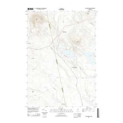
1987 Lead Mountain
Washington County, ME

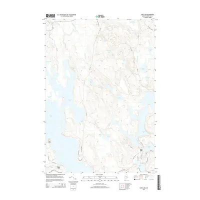
1987 Long Lake
Washington County, ME

1987 Meddybemps Lake East
Washington County, ME

1987 Meddybemps Lake West
Washington County, ME

1987 Porcupine Mountain
Washington County, ME

1987 Woodland
Washington County, ME

1988 Brookton
Washington County, ME

1988 Dill Hill
Washington County, ME

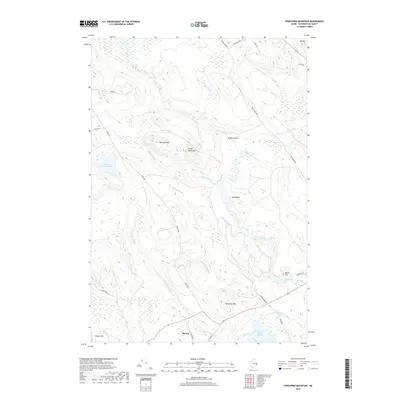
1988 Farrow Mountain
Washington County, ME

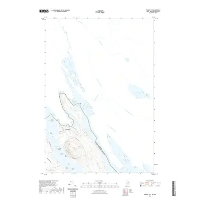
1988 Forest City
Washington County, ME

1988 Forest
Washington County, ME

1988 Kelleyland
Washington County, ME

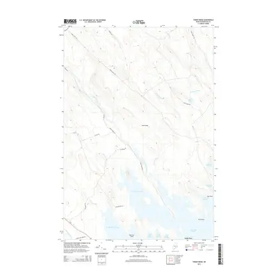
1988 Lambert Lake
Washington County, ME

1988 Loon Bay
Washington County, ME

1988 Oxbrook Lakes
Washington County, ME

1988 Scraggly Lake
Washington County, ME

1988 Simsquish Lake
Washington County, ME

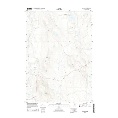
1988 Stetson Mountain
Washington County, ME

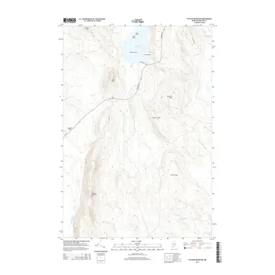
1988 Tomah Mountain
Washington County, ME

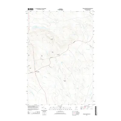
1988 Tomah Ridge
Washington County, ME

1988 Waite
Washington County, ME

1990 Big Lake
Washington County, ME

1990 Bog Lake
Washington County, ME

1990 Clifford Lake
Washington County, ME

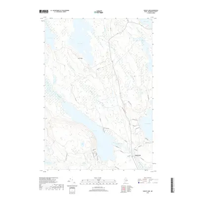
1990 Crawford Lake
Washington County, ME

1990 Dark Cove Mountain
Washington County, ME

1990 Fletcher Peak
Washington County, ME

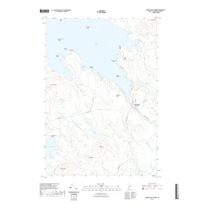
1990 Grand Lake Stream
Washington County, ME

1990 Monroe Lake
Washington County, ME

1990 Montegail Pond
Washington County, ME

1990 Northeast Bluff
Washington County, ME

1990 Peaked Mountain Pond
Washington County, ME

1990 Peaked Mountain
Washington County, ME

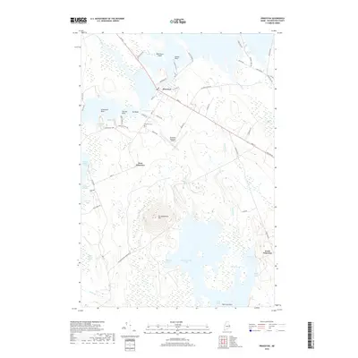
1990 Princeton
Washington County, ME

1990 Round Lake
Washington County, ME

1990 Tug Mountain
Washington County, ME

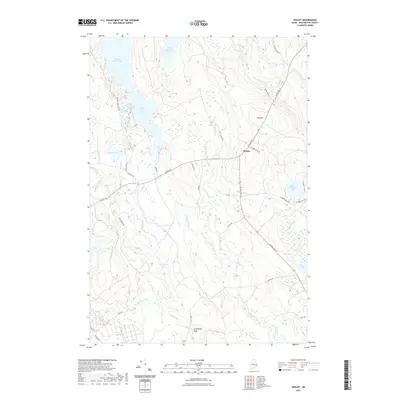
1990 Wesley
Washington County, ME

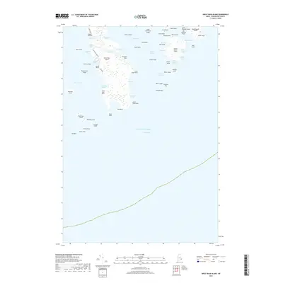
1993 Cross Island
Washington County, ME

1993 Cutler
Washington County, ME

1993 Machias Bay
Washington County, ME

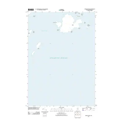
1993 Machias Seal Island South
Washington County, ME

1993 Machias Seal Island
Washington County, ME

1993 Moose River
Washington County, ME

1993 Old Man
Washington County, ME

1994 Machias
Washington County, ME
2011 Addison
Washington County, ME
2011 Big Lake
Washington County, ME
2011 Bog Lake
Washington County, ME
2011 Bois Bubert
Washington County, ME
2011 Brookton
Washington County, ME
2011 Cherryfield
Washington County, ME
2011 Clifford Lake
Washington County, ME
2011 Columbia Falls
Washington County, ME
2011 Crawford Lake
Washington County, ME
2011 Cross Island
Washington County, ME
2011 Cutler
Washington County, ME
2011 Dark Cove Mountain
Washington County, ME
2011 Devils Head
Washington County, ME
2011 Dill Hill
Washington County, ME
2011 Drisko Island
Washington County, ME
2011 Eastport OE E
Washington County, ME
2011 Epping
Washington County, ME
2011 Farrow Mountain
Washington County, ME
2011 Fletcher Peak
Washington County, ME
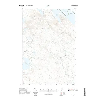
2011 Forest City
Washington County, ME
2011 Forest
Washington County, ME
2011 Grand Lake Stream
Washington County, ME
2011 Great Wass Island
Washington County, ME
2011 Hadley Lake
Washington County, ME
2011 Harrington
Washington County, ME
2011 Kelleyland
Washington County, ME
2011 Lake Cathance
Washington County, ME
2011 Lambert Lake
Washington County, ME
2011 Lead Mountain
Washington County, ME
2011 Long Lake
Washington County, ME
2011 Loon Bay
Washington County, ME
2011 Lubec
Washington County, ME
2011 Machias Bay
Washington County, ME
2011 Machias
Washington County, ME
2011 Meddybemps Lake East
Washington County, ME
2011 Meddybemps Lake West
Washington County, ME
2011 Monroe Lake
Washington County, ME
2011 Montegail Pond
Washington County, ME
2011 Moose River
Washington County, ME
2011 Northeast Bluff
Washington County, ME
2011 Old Man
Washington County, ME
2011 Oxbrook Lakes
Washington County, ME
2011 Peaked Mountain Pond
Washington County, ME
2011 Peaked Mountain
Washington County, ME
2011 Pembroke
Washington County, ME
2011 Petit Manan Point
Washington County, ME
2011 Porcupine Mountain
Washington County, ME
2011 Princeton
Washington County, ME
2011 Red Beach
Washington County, ME
2011 Robbinston
Washington County, ME
2011 Roque Bluffs
Washington County, ME
2011 Round Lake
Washington County, ME
2011 Schoodic Lake
Washington County, ME
2011 Scraggly Lake
Washington County, ME
2011 Simsquish Lake
Washington County, ME
2011 Stetson Mountain
Washington County, ME
2011 Tomah Mountain
Washington County, ME
2011 Tomah Ridge
Washington County, ME
2011 Tug Mountain
Washington County, ME
2011 Waite
Washington County, ME
2011 Wesley
Washington County, ME
2011 West Lubec
Washington County, ME
2011 Whiting
Washington County, ME
2011 Whitneyville
Washington County, ME
2011 Woodland
Washington County, ME
2014 Addison
Washington County, ME
2014 Big Lake
Washington County, ME
2014 Bog Lake
Washington County, ME
2014 Bois Bubert OE S
Washington County, ME
2014 Bois Bubert
Washington County, ME
2014 Brookton
Washington County, ME
2014 Cherryfield
Washington County, ME
2014 Clifford Lake
Washington County, ME
2014 Columbia Falls
Washington County, ME
2014 Crawford Lake
Washington County, ME
2014 Cross Island
Washington County, ME
2014 Cutler
Washington County, ME
2014 Dark Cove Mountain
Washington County, ME
2014 Devils Head OE E
Washington County, ME
2014 Devils Head
Washington County, ME
2014 Dill Hill
Washington County, ME
2014 Drisko Island
Washington County, ME
2014 Eastport OE E
Washington County, ME
2014 Epping
Washington County, ME
2014 Farrow Mountain
Washington County, ME
2014 Fletcher Peak
Washington County, ME
2014 Forest City
Washington County, ME
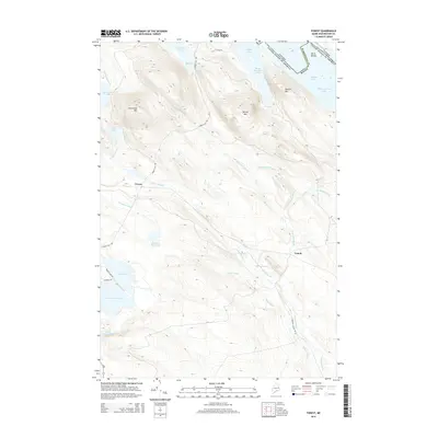
2014 Forest
Washington County, ME
2014 Grand Lake Stream
Washington County, ME
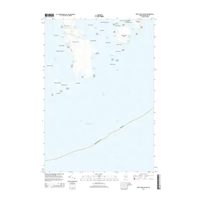
2014 Great Wass Island
Washington County, ME
2014 Hadley Lake
Washington County, ME
2014 Harrington
Washington County, ME
2014 Kelleyland
Washington County, ME
2014 Lake Cathance
Washington County, ME
2014 Lambert Lake
Washington County, ME
2014 Lead Mountain
Washington County, ME
2014 Long Lake
Washington County, ME
2014 Loon Bay
Washington County, ME
2014 Lubec
Washington County, ME
2014 Machias Bay
Washington County, ME

2014 Machias Seal Island South
Washington County, ME
2014 Machias Seal Island
Washington County, ME
2014 Machias
Washington County, ME
2014 Meddybemps Lake East
Washington County, ME
2014 Meddybemps Lake West
Washington County, ME
2014 Monroe Lake
Washington County, ME
2014 Montegail Pond
Washington County, ME
2014 Moose River
Washington County, ME
2014 Northeast Bluff
Washington County, ME
2014 Old Man
Washington County, ME
2014 Oxbrook Lakes
Washington County, ME
2014 Peaked Mountain Pond
Washington County, ME
2014 Peaked Mountain
Washington County, ME
2014 Pembroke
Washington County, ME
2014 Petit Manan Point
Washington County, ME
2014 Porcupine Mountain
Washington County, ME
2014 Princeton
Washington County, ME
2014 Red Beach
Washington County, ME
2014 Robbinston
Washington County, ME
2014 Roque Bluffs
Washington County, ME
2014 Round Lake
Washington County, ME
2014 Schoodic Lake
Washington County, ME
2014 Scraggly Lake
Washington County, ME
2014 Simsquish Lake
Washington County, ME
2014 Stetson Mountain
Washington County, ME
2014 Tomah Mountain
Washington County, ME
2014 Tomah Ridge
Washington County, ME
2014 Tug Mountain
Washington County, ME
2014 Waite
Washington County, ME
2014 Wesley
Washington County, ME
2014 West Lubec
Washington County, ME
2014 Whiting
Washington County, ME
2014 Whitneyville
Washington County, ME
2014 Woodland
Washington County, ME
2018 Addison
Washington County, ME
2018 Big Lake
Washington County, ME
2018 Bog Lake
Washington County, ME
2018 Bois Bubert OE S
Washington County, ME
2018 Bois Bubert
Washington County, ME
2018 Brookton
Washington County, ME
2018 Cherryfield
Washington County, ME
2018 Clifford Lake
Washington County, ME
2018 Columbia Falls
Washington County, ME
2018 Crawford Lake
Washington County, ME
2018 Cross Island
Washington County, ME
2018 Cutler
Washington County, ME
2018 Dark Cove Mountain
Washington County, ME
2018 Devils Head OE E
Washington County, ME

2018 Devils Head
Washington County, ME
2018 Dill Hill
Washington County, ME
2018 Drisko Island
Washington County, ME
2018 Eastport OE E
Washington County, ME
2018 Epping
Washington County, ME

2018 Farrow Mountain
Washington County, ME
2018 Fletcher Peak
Washington County, ME
2018 Forest City
Washington County, ME
2018 Forest
Washington County, ME
2018 Grand Lake Stream
Washington County, ME
2018 Great Wass Island
Washington County, ME
2018 Hadley Lake
Washington County, ME
2018 Harrington
Washington County, ME
2018 Kelleyland
Washington County, ME
2018 Lake Cathance
Washington County, ME
2018 Lambert Lake
Washington County, ME
2018 Lead Mountain
Washington County, ME
2018 Long Lake
Washington County, ME
2018 Loon Bay
Washington County, ME
2018 Lubec
Washington County, ME

2018 Machias Bay
Washington County, ME
2018 Machias Seal Island
Washington County, ME
2018 Machias
Washington County, ME
2018 Meddybemps Lake East
Washington County, ME
2018 Meddybemps Lake West
Washington County, ME
2018 Monroe Lake
Washington County, ME
2018 Montegail Pond
Washington County, ME
2018 Moose River
Washington County, ME
2018 Northeast Bluff
Washington County, ME
2018 Old Man
Washington County, ME
2018 Oxbrook Lakes
Washington County, ME
2018 Peaked Mountain Pond
Washington County, ME
2018 Peaked Mountain
Washington County, ME
2018 Pembroke
Washington County, ME
2018 Petit Manan Point
Washington County, ME
2018 Porcupine Mountain
Washington County, ME
2018 Princeton
Washington County, ME
2018 Red Beach
Washington County, ME
2018 Robbinston
Washington County, ME
2018 Roque Bluffs
Washington County, ME
2018 Round Lake
Washington County, ME
2018 Schoodic Lake
Washington County, ME
2018 Scraggly Lake
Washington County, ME
2018 Simsquish Lake
Washington County, ME
2018 Stetson Mountain
Washington County, ME

2018 Tomah Mountain
Washington County, ME
2018 Tomah Ridge
Washington County, ME
2018 Tug Mountain
Washington County, ME
2018 Waite
Washington County, ME
2018 Wesley
Washington County, ME
2018 West Lubec
Washington County, ME
2018 Whiting
Washington County, ME
2018 Whitneyville
Washington County, ME
2018 Woodland
Washington County, ME
2021 Addison
Washington County, ME
2021 Big Lake
Washington County, ME
2021 Bog Lake
Washington County, ME
2021 Bois Bubert OE S
Washington County, ME

2021 Bois Bubert
Washington County, ME
2021 Brookton
Washington County, ME
2021 Cherryfield
Washington County, ME
2021 Clifford Lake
Washington County, ME
2021 Columbia Falls
Washington County, ME

2021 Crawford Lake
Washington County, ME
2021 Cross Island
Washington County, ME
2021 Cutler
Washington County, ME
2021 Dark Cove Mountain
Washington County, ME
2021 Devils Head OE E
Washington County, ME
2021 Devils Head
Washington County, ME
2021 Dill Hill
Washington County, ME
2021 Drisko Island
Washington County, ME

2021 Eastport OE E
Washington County, ME
2021 Epping
Washington County, ME
2021 Farrow Mountain
Washington County, ME
2021 Fletcher Peak
Washington County, ME
2021 Forest City
Washington County, ME
2021 Forest
Washington County, ME
2021 Grand Lake Stream
Washington County, ME
2021 Great Wass Island
Washington County, ME
2021 Hadley Lake
Washington County, ME
2021 Harrington
Washington County, ME
2021 Kelleyland
Washington County, ME
2021 Lake Cathance
Washington County, ME

2021 Lambert Lake
Washington County, ME
2021 Lead Mountain
Washington County, ME
2021 Long Lake
Washington County, ME
2021 Loon Bay
Washington County, ME

2021 Lubec
Washington County, ME
2021 Machias Bay
Washington County, ME
2021 Machias Seal Island
Washington County, ME
2021 Machias
Washington County, ME
2021 Meddybemps Lake East
Washington County, ME
2021 Meddybemps Lake West
Washington County, ME
2021 Monroe Lake
Washington County, ME
2021 Montegail Pond
Washington County, ME
2021 Moose River
Washington County, ME
2021 Northeast Bluff
Washington County, ME
2021 Old Man
Washington County, ME
2021 Oxbrook Lakes
Washington County, ME
2021 Peaked Mountain Pond
Washington County, ME
2021 Peaked Mountain
Washington County, ME

2021 Pembroke
Washington County, ME
2021 Petit Manan Point
Washington County, ME
2021 Porcupine Mountain
Washington County, ME
2021 Princeton
Washington County, ME
2021 Red Beach
Washington County, ME

2021 Robbinston
Washington County, ME
2021 Roque Bluffs
Washington County, ME
2021 Round Lake
Washington County, ME
2021 Schoodic Lake
Washington County, ME
2021 Scraggly Lake
Washington County, ME
2021 Simsquish Lake
Washington County, ME
2021 Stetson Mountain
Washington County, ME
2021 Tomah Mountain
Washington County, ME
2021 Tomah Ridge
Washington County, ME
2021 Tug Mountain
Washington County, ME
2021 Waite
Washington County, ME
2021 Wesley
Washington County, ME
2021 West Lubec
Washington County, ME
2021 Whiting
Washington County, ME
2021 Whitneyville
Washington County, ME
2021 Woodland
Washington County, ME

2024 Addison
Washington County, ME

2024 Big Lake
Washington County, ME

2024 Bog Lake
Washington County, ME

2024 Bois Bubert OE S
Washington County, ME

2024 Bois Bubert
Washington County, ME

2024 Brookton
Washington County, ME

2024 Cherryfield
Washington County, ME

2024 Clifford Lake
Washington County, ME

2024 Columbia Falls
Washington County, ME

2024 Crawford Lake
Washington County, ME

2024 Cross Island
Washington County, ME

2024 Cutler
Washington County, ME

2024 Dark Cove Mountain
Washington County, ME

2024 Devils Head OE E
Washington County, ME

2024 Devils Head
Washington County, ME

2024 Dill Hill
Washington County, ME

2024 Drisko Island
Washington County, ME

2024 Eastport OE E
Washington County, ME

2024 Epping
Washington County, ME

2024 Farrow Mountain
Washington County, ME

2024 Fletcher Peak
Washington County, ME

2024 Forest City
Washington County, ME

2024 Forest
Washington County, ME

2024 Grand Lake Stream
Washington County, ME

2024 Great Wass Island
Washington County, ME

2024 Hadley Lake
Washington County, ME

2024 Harrington
Washington County, ME

2024 Kelleyland
Washington County, ME

2024 Lake Cathance
Washington County, ME

2024 Lambert Lake
Washington County, ME

2024 Lead Mountain
Washington County, ME

2024 Long Lake
Washington County, ME

2024 Loon Bay
Washington County, ME

2024 Lubec
Washington County, ME

2024 Machias Bay
Washington County, ME

2024 Machias Seal Island
Washington County, ME

2024 Machias
Washington County, ME

2024 Meddybemps Lake East
Washington County, ME

2024 Meddybemps Lake West
Washington County, ME

2024 Monroe Lake
Washington County, ME

2024 Montegail Pond
Washington County, ME

2024 Moose River
Washington County, ME

2024 Northeast Bluff
Washington County, ME

2024 Old Man
Washington County, ME

2024 Oxbrook Lakes
Washington County, ME

2024 Peaked Mountain Pond
Washington County, ME

2024 Peaked Mountain
Washington County, ME

2024 Pembroke
Washington County, ME

2024 Petit Manan Point
Washington County, ME

2024 Porcupine Mountain
Washington County, ME

2024 Princeton
Washington County, ME

2024 Red Beach
Washington County, ME

2024 Robbinston
Washington County, ME

2024 Roque Bluffs
Washington County, ME

2024 Round Lake
Washington County, ME

2024 Schoodic Lake
Washington County, ME

2024 Scraggly Lake
Washington County, ME

2024 Simsquish Lake
Washington County, ME

2024 Stetson Mountain
Washington County, ME

2024 Tomah Mountain
Washington County, ME

2024 Tomah Ridge
Washington County, ME

2024 Tug Mountain
Washington County, ME

2024 Waite
Washington County, ME

2024 Wesley
Washington County, ME

2024 West Lubec
Washington County, ME

2024 Whiting
Washington County, ME

2024 Whitneyville
Washington County, ME

2024 Woodland
Washington County, ME