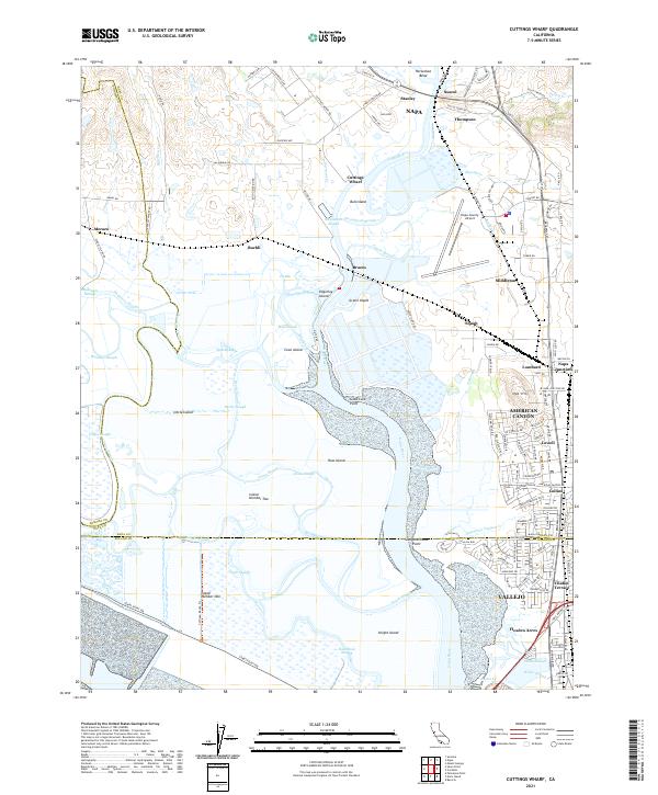
2021 Map of Cuttings Wharf
USGS Topo · Published 2021About this map
The Napa River winds through a complex network of wetlands and tidal sloughs at the northern edge of San Pablo Bay, defining a landscape of low-lying islands and maritime infrastructure. Settlements such as Cuttings Wharf and Brazos sit at the transition between the river's deep channels and the surrounding marshlands, which include Bull Island, Russ Island, and Knight Island. The map records a distinct contrast between the natural curves of Fagan Slough and the industrial development characterizing the eastern corridor.
Find a feature on this map
132 named features on this map. Tap any name to fly to it.
Don’t see what you’re looking for? This feature index may not catch every label — zoom into the map to look around manually.
Map Details
Editions of this 2021 Cuttings Wharf Map
This is the sole edition of this map. No revisions or reprints were ever made.
Other maps of this area

1896 · Carquinez Strait
USGS Topo · 1:62,500

1898 · Karquines
USGS Topo · 1:62,500

1901 · Karquines
USGS Topo · 1:62,500

1902 · Napa
USGS Topo · 1:125,000

1916 · Mare Island
USGS Topo · 1:62,500

1921 · Mt. Vaca
USGS Topo · 1:62,500

1940 · Carquinez Strait
USGS Topo · 1:62,500

1942 · Mare Island
USGS Topo · 1:62,500

1942 · Carquinez
USGS Topo · 1:62,500

1942 · Sonoma
USGS Topo · 1:62,500