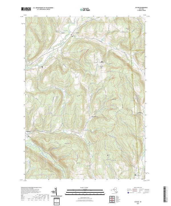
2023 Map of Cuyler
USGS Topo · Published 2023About this map
Cuyler and its surrounding hamlets occupy a high-relief landscape where the East Branch Tioughnioga River meets Maxon Creek. This modern survey illustrates a rural New York geography defined by its steep hills and narrow valleys, including Dog Hollow and the prominent Bull Hill. The map is particularly useful for genealogical research, identifying numerous small family-named landmarks and burial sites such as Winne Cem and the Potter Hill Cem. Smaller settlements like Tripoli and New Boston remain connected by a network of county roads and historical pathways like the North Country National Scenic Trl. The map also captures the convergence of county boundaries where Cortland, Madison, and Chenango counties meet, a detail often critical for property history and local record searching in this region.
Find a feature on this map
78 named features on this map. Tap any name to fly to it.
Don’t see what you’re looking for? This feature index may not catch every label — zoom into the map to look around manually.
Map Details
Editions of this 2023 Cuyler Map
This is the sole edition of this map. No revisions or reprints were ever made.
Other maps of this area

1897 · Cazenovia
USGS Topo · 1:62,500

1899 · Cazenovia
USGS Topo · 1:62,500

1900 · Tully
USGS Topo · 1:62,500

1903 · Cortland
USGS Topo · 1:62,500

1904 · Pitcher
USGS Topo · 1:62,500
1943 · Tully
USGS Topo · 1:24,000

1943 · De Ruyter
USGS Topo · 1:24,000

1943 · South Ostelic
USGS Topo · 1:24,000

1943 · Cincinnatus
USGS Topo · 1:24,000
1943 · Erieville
USGS Topo · 1:24,000