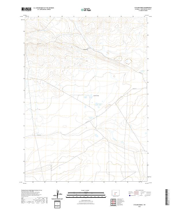
2021 Map of Cyclone Draw
USGS Topo · Published 2021About this map
Cyclone Rim dominates the upper elevations of this high desert terrain in Sweetwater County, marking a distinct topographical transition above the basin floor. The drainage system of Cyclone Draw funnels toward a cluster of ephemeral water bodies known as Stratton Lakes, which serve as a focal point for the surrounding public land. This 2021 survey illustrates a landscape largely defined by its Bureau of Land Management infrastructure, where routes like Blm Rd 3216 and Blm Rd 3214 provide the primary access for livestock management and resource monitoring. The map preserves the exact township and range boundaries of the Public Land Survey System, including t26n r96w and t25n r95w, which remain the fundamental framework for land ownership and administration in this part of Wyoming.
Find a feature on this map
9 named features on this map. Tap any name to fly to it.
Don’t see what you’re looking for? This feature index may not catch every label — zoom into the map to look around manually.
Map Details
Editions of this 2021 Cyclone Draw Map
This is the sole edition of this map. No revisions or reprints were ever made.
Other maps of this area

1955 · Lander
USGS Topo · 1:250,000

1958 · Lander
USGS Topo · 1:250,000

1960 · Five Fingers Butte
USGS Topo · 1:62,500

1960 · Lost Creek Lake
USGS Topo · 1:62,500

1961 · Lander
USGS Topo · 1:250,000
1961 · Lost Creek Reservoir
USGS Topo · 1:24,000
1961 · Olson Springs
USGS Topo · 1:24,000
1961 · Sulphur Bar Spring
USGS Topo · 1:24,000
1984 · South Pass
USGS Topo · 1:100,000
1988 · Lost Creek Lake
USGS Topo · 1:24,000