
1960 Map of Lost Creek Lake
USGS Topo · Published 1963About this map
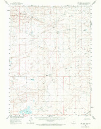
Lost Creek Basin defines this high-desert landscape in Sweetwater County, where the 1960 topography reveals a network of ephemeral water sources and isolated livestock or sheep-herding landmarks. The presence of the Hadsell Cabin and the nearby Hadsell Road suggests the enduring influence of the Hadsell family on this region's ranching history. Water management is central to the area's utility, marked by the Osborne Reservoir and Lost Creek Lake, alongside natural features like Stratton Lakes and Mud Lake.
Find a feature on this map
33 named features on this map. Tap any name to fly to it.
Don’t see what you’re looking for? This feature index may not catch every label — zoom into the map to look around manually.
Map Details
Editions of this 1960 Lost Creek Lake Map
2 editions found
Other maps of this area

1954 · Rawlins
USGS Topo · 1:250,000

1954 · Rock Springs
USGS Topo · 1:250,000

1955 · Lander
USGS Topo · 1:250,000

1955 · Casper
USGS Topo · 1:250,000

1958 · Rawlins
USGS Topo · 1:250,000

1958 · Casper
USGS Topo · 1:250,000

1958 · Lander
USGS Topo · 1:250,000

1958 · Rock Springs
USGS Topo · 1:250,000

1960 · Red Lake
USGS Topo · 1:62,500

1960 · Battle Spring
USGS Topo · 1:24,000