
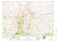
1958 Map of Rock Springs
USGS Topo · Published 1958About this map
Rock Springs serves as the industrial and transportation hub for this high-desert region during the mid-1950s, where the Union Pacific railroad and U.S. 30 align along the course of Bitter Creek. The landscape transitions from the volcanic heights of the Leucite Hills and Steamboat Mountain in the north to the vast, arid expanse of the Great Divide Basin in the northeast. This era shows the critical role of energy and ranching in the Sweetwater County economy, evidenced by numerous Gas wells scattered across the terrain and isolated family operations such as Barnhart Ranch and the Erikson Kent Ranch. Natural corridors like the Green River and Killpecker Creek define the movement of water through the sagebrush and mesas, while the presence of the CAA Building near the rail line highlights the early infrastructure supporting transcontinental aviation and communication in the Wyoming interior.
Find a feature on this map
70 named features on this map. Tap any name to fly to it.
Don’t see what you’re looking for? This feature index may not catch every label — zoom into the map to look around manually.
Map Details
Editions of this 1958 Rock Springs Map
2 editions found
Other maps of this area

1885 · Ashley
USGS Topo · 1:250,000

1885 · Uinta
USGS Topo · 1:250,000

1905 · Gilbert Peak
USGS Topo · 1:125,000

1906 · Gilbert Peak
USGS Topo · 1:125,000

1906 · Marsh Peak
USGS Topo · 1:125,000

1908 · Marsh Peak
USGS Topo · 1:125,000

1908 · Rock Springs
USGS Topo · 1:62,500

1910 · Rock Springs
USGS Topo · 1:62,500

1916 · Craig
USGS Topo · 1:125,000

1952 · Willow Creek Butte
USGS Topo · 1:24,000