
1960 Map of Battle Spring
USGS Topo · Published 1962About this map
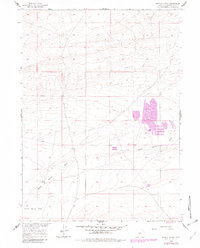
Battle Spring serves as the focal point for this high-desert landscape in Sweetwater County, where the terrain transitions from the wide Battle Spring Flat to the etched drainage of Battle Spring Draw. Mapping efforts conducted for the Department of the Interior's Missouri River Basin development program record a sparse but functional infrastructure focused on water access and mineral potential. The north-south corridor of the Wamsutter Crooks Gap Road provides the primary transit route through this arid region, linking remote points across the Great Divide Basin. Evidence of early land use is found in scattered markings, including a Well and a site labeled simply as Prospect, indicating the era's localized attempts at resource extraction and ranching support.
Find a feature on this map
9 named features on this map. Tap any name to fly to it.
Don’t see what you’re looking for? This feature index may not catch every label — zoom into the map to look around manually.
Map Details
Editions of this 1960 Battle Spring Map
2 editions found
Other maps of this area

1954 · Rawlins
USGS Topo · 1:250,000

1954 · Rock Springs
USGS Topo · 1:250,000

1955 · Lander
USGS Topo · 1:250,000

1955 · Casper
USGS Topo · 1:250,000

1958 · Rawlins
USGS Topo · 1:250,000

1958 · Casper
USGS Topo · 1:250,000

1958 · Lander
USGS Topo · 1:250,000

1958 · Rock Springs
USGS Topo · 1:250,000

1960 · Hansen Lake NE
USGS Topo · 1:24,000

1960 · Sooner Reservoir
USGS Topo · 1:24,000