
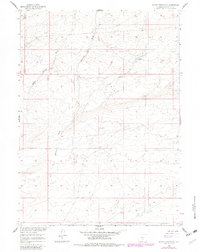
1960 Map of Sooner Reservoir
USGS Topo · Published 1962About this map
Stratton Draw and Battle Spring Draw carve through this high desert terrain in the Missouri River Basin during the early 1960s. The landscape reflects the sparse, functional settlement patterns of Sweetwater County, defined by livestock management and water access. At the heart of the sheet lies a Sheep Camp and a solitary Well, indicating the vital infrastructure required for ranching in this arid environment. The presence of Sooner Reservoir further highlights the systematic efforts to capture and manage runoff within this drainage system. Beyond these landmarks, the map is primarily characterized by the natural contours of the land and unimproved dirt tracks leading toward distant regional hubs like Battle Spring and Chicken Spring.
Find a feature on this map
10 named features on this map. Tap any name to fly to it.
Don’t see what you’re looking for? This feature index may not catch every label — zoom into the map to look around manually.
Map Details
Editions of this 1960 Sooner Reservoir Map
2 editions found
Other maps of this area

1954 · Rawlins
USGS Topo · 1:250,000

1955 · Casper
USGS Topo · 1:250,000

1958 · Rawlins
USGS Topo · 1:250,000

1958 · Casper
USGS Topo · 1:250,000

1960 · Battle Spring
USGS Topo · 1:24,000

1960 · Hansen Lake NE
USGS Topo · 1:24,000

1960 · Larsen Knoll
USGS Topo · 1:24,000

1960 · Hansen Lake
USGS Topo · 1:24,000

1960 · Chicken Spring
USGS Topo · 1:24,000
1961 · Osborne Well
USGS Topo · 1:24,000