
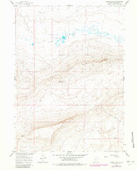
1960 Map of Hansen Lake NE
USGS Topo · Published 1962About this map
Chain Lakes Flat and the surrounding high desert terrain define this portion of Sweetwater County during the early 1960s. The landscape is dominated by the prominent escarpment of Chain Lakes Rim, which separates the low-lying alkali flats and water bodies from the higher elevations to the south. This area, mapped for the development of the Missouri River Basin, reveals a sparse but functional network of desert infrastructure, including the Riner Cutoff Road and isolated water sources like a Spring and a Well. The presence of Stratton Camp suggests a point of human activity within this arid environment, likely associated with ranching or resource management. The map's detail preserves the specific topography of the Chain Lakes region before modern modifications, offering a clear view of the natural drainage and land-use patterns of the era.
Find a feature on this map
9 named features on this map. Tap any name to fly to it.
Don’t see what you’re looking for? This feature index may not catch every label — zoom into the map to look around manually.
Map Details
Editions of this 1960 Hansen Lake NE Map
2 editions found
Other maps of this area

1954 · Rawlins
USGS Topo · 1:250,000

1955 · Casper
USGS Topo · 1:250,000

1958 · Rawlins
USGS Topo · 1:250,000

1958 · Casper
USGS Topo · 1:250,000

1960 · Battle Spring
USGS Topo · 1:24,000

1960 · Sooner Reservoir
USGS Topo · 1:24,000

1960 · Larsen Knoll
USGS Topo · 1:24,000

1960 · Hansen Lake
USGS Topo · 1:24,000

1960 · Chicken Spring
USGS Topo · 1:24,000

1962 · Rawlins
USGS Topo · 1:250,000