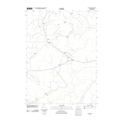
2010 Map of Cyclone
USGS Topo · Published 2010About this map
Bradford Oil Field and Ormsby Oil Field dominate the northern and central highlands of this McKean County landscape, highlighting the region's enduring energy extraction history. The terrain is deeply incised by drainages such as Kinzua Creek and South Branch Cole Creek, which carve out notable features like Wildcat Hollow and the Kinzua Gorge. In the southern portion of the map, Kinzua Bridge State Park contains the site of the iconic Kinzua Bridge, providing a clear look at the area's transition from an industrial corridor to a protected landscape.
Find a feature on this map
43 named features on this map. Tap any name to fly to it.
Don’t see what you’re looking for? This feature index may not catch every label — zoom into the map to look around manually.
Map Details
Editions of this 2010 Cyclone Map
This is the sole edition of this map. No revisions or reprints were ever made.
Other maps of this area

1924 · Bradford
USGS Topo · 1:62,500

1926 · Bradford
USGS Topo · 1:62,500

1933 · Smethport
USGS Topo · 1:62,500

1935 · Mt. Jewett
USGS Topo · 1:48,000

1937 · Smethport
USGS Topo · 1:62,500

1940 · Mt. Jewett
USGS Topo · 1:62,500

1941 · Bradford
USGS Topo · 1:62,500

1944 · Bradford
USGS Topo · 1:62,500

1948 · Crosby
USGS Topo · 1:62,500
1948 · Crosby
USGS Topo · 1:24,000
Featured Places
- Lafayette Township, PA
- Gaffney, Hamlin Township
- Cyclone, Keating Township
- Gifford, Keating Township
- Simpson, Keating Township