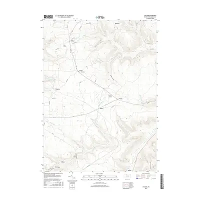
2016 Map of Cyclone
USGS Topo · Published 2016About this map
Cyclone and the surrounding highlands of McKean County define this landscape, where deep valleys and high summits dictate the local infrastructure. The terrain is marked by significant topographical shifts, from the heights of Ormsbsy Summit down into the dramatic Kinzua Gorge. Waterways like Kinzua Cr and Minard Run carve through the plateau, creating a network of hollows such as Wildcat Hollow and McQuen Hollow.
Find a feature on this map
53 named features on this map. Tap any name to fly to it.
Don’t see what you’re looking for? This feature index may not catch every label — zoom into the map to look around manually.
Map Details
Editions of this 2016 Cyclone Map
This is the sole edition of this map. No revisions or reprints were ever made.
Other maps of this area

1924 · Bradford
USGS Topo · 1:62,500

1926 · Bradford
USGS Topo · 1:62,500

1933 · Smethport
USGS Topo · 1:62,500

1935 · Mt. Jewett
USGS Topo · 1:48,000

1937 · Smethport
USGS Topo · 1:62,500

1940 · Mt. Jewett
USGS Topo · 1:62,500

1941 · Bradford
USGS Topo · 1:62,500

1944 · Bradford
USGS Topo · 1:62,500

1948 · Crosby
USGS Topo · 1:62,500
1948 · Crosby
USGS Topo · 1:24,000
Featured Places
- Lafayette Township, PA
- Gaffney, Hamlin Township
- Cyclone, Keating Township
- Gifford, Keating Township
- Simpson, Keating Township