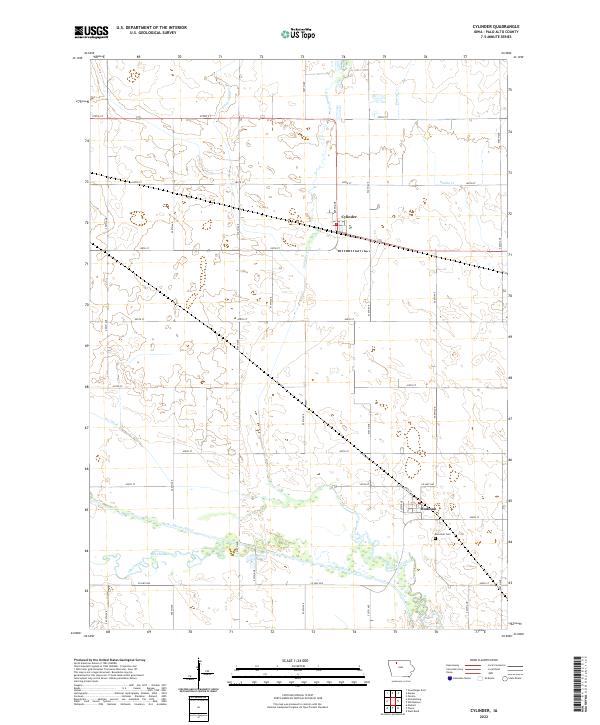
2022 Map of Cylinder
USGS Topo · Published 2022About this map
Cylinder and Rodman anchor this agricultural landscape in Palo Alto County, where the grid of rural roads meets the winding path of the Des Moines River. The terrain is defined by its complex drainage network, ranging from the naturally meandering Cylinder Creek and Prairie Cr to engineered water management features like Ditch Number 80 and Dry Ditch. These waterways underscore the history of land use and water control in the region. Near the southern bend of the river, Riverside Cem serves as a quiet landmark for local genealogists, while the Old Channel reveals the former course of the river before its modern path was established. The map meticulously documents the intersection of rail and road infrastructure that once supported these small prairie settlements.
Find a feature on this map
36 named features on this map. Tap any name to fly to it.
Don’t see what you’re looking for? This feature index may not catch every label — zoom into the map to look around manually.
Map Details
Editions of this 2022 Cylinder Map
This is the sole edition of this map. No revisions or reprints were ever made.
Other maps of this area

1954 · Fairmont
USGS Topo · 1:250,000

1954 · Fort Dodge
USGS Topo · 1:250,000

1957 · Fort Dodge
USGS Topo · 1:250,000

1958 · Fort Dodge
USGS Topo · 1:250,000

1958 · Fairmont
USGS Topo · 1:250,000

1980 · Fenton
USGS Topo · 1:24,000

1980 · Depew
USGS Topo · 1:24,000
1980 · Mallard
USGS Topo · 1:24,000

1980 · Plover
USGS Topo · 1:24,000

1980 · Graettinger East
USGS Topo · 1:24,000