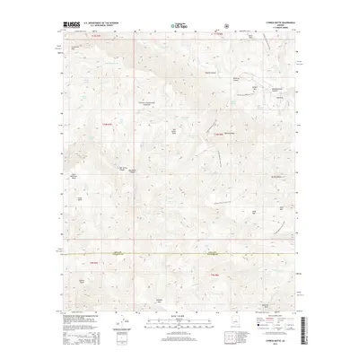
2014 Map of Cypress Butte
USGS Topo · Published 2014About this map
The E Verde River carves through this northern portion of the Tonto National Forest, defining a landscape of high mesas and deep canyons along the border of Gila and Yavapai counties. This 2014 survey documents a territory dominated by significant landforms such as Polles Mesa and Midnight Mesa, alongside the namesake Cypress Butte in the southwest. The Arizona National Scenic Trail serves as the primary artery for navigation through this drainage system, winding past Copper Mtn and across the Bullfrog Ridge. The map reveals a complex network of springs and tanks essential for life in this arid environment, including Clover Spring, Childers Seep, and Red Metal Tank. From the depths of Hells Hole to the heights of Knob Mtn, the drainage patterns of Wet Bottom Cr and Houston Cr illustrate the dramatic topography of the Arizona backcountry.
Find a feature on this map
57 named features on this map. Tap any name to fly to it.
Don’t see what you’re looking for? This feature index may not catch every label — zoom into the map to look around manually.
Map Details
Editions of this 2014 Cypress Butte Map
This is the sole edition of this map. No revisions or reprints were ever made.
Other maps of this area

1887 · Verde
USGS Topo · 1:250,000

1892 · Verde
USGS Topo · 1:250,000

1929 · Turret Peak
USGS Topo · 1:125,000

1933 · Turret Peak
USGS Topo · 1:125,000

1934 · Pine
USGS Topo · 1:62,500

1936 · Payson
USGS Topo · 1:48,000

1940 · Pine
USGS Topo · 1:62,500

1942 · Payson
USGS Topo · 1:62,500

1952 · Pine
USGS Topo · 1:62,500

1954 · Holbrook
USGS Topo · 1:250,000