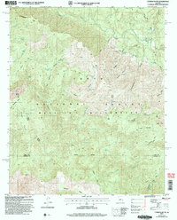
2004 Map of Cypress Butte
USGS Topo · Published 2006About this map
The confluence of the Verde River and the East Verde River defines this high-desert landscape on the border of Gila and Yavapai Counties. This 2004 revision by the Forest Service depicts a rugged interior within the Tonto National Forest, characterized by complex topography like the Mazatzal Divide and isolated landmarks such as Cypress Butte. Settlement is sparse, represented by the LF Ranch and a remote Cabin near Bull Trap Spring.
Find a feature on this map
57 named features on this map. Tap any name to fly to it.
Don’t see what you’re looking for? This feature index may not catch every label — zoom into the map to look around manually.
Map Details
Editions of this 2004 Cypress Butte Map
This is the sole edition of this map. No revisions or reprints were ever made.
Other maps of this area

1887 · Verde
USGS Topo · 1:250,000

1892 · Verde
USGS Topo · 1:250,000

1929 · Turret Peak
USGS Topo · 1:125,000

1933 · Turret Peak
USGS Topo · 1:125,000

1934 · Pine
USGS Topo · 1:62,500

1936 · Payson
USGS Topo · 1:48,000

1940 · Pine
USGS Topo · 1:62,500

1942 · Payson
USGS Topo · 1:62,500

1952 · Pine
USGS Topo · 1:62,500

1954 · Holbrook
USGS Topo · 1:250,000