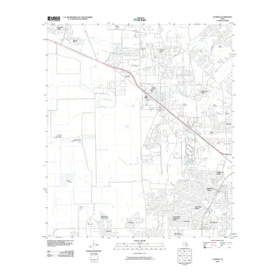
2010 Map of Cypress
USGS Topo · Published 2010About this map
Cypress and its surrounding residential developments define this suburban landscape northwest of Houston during the early 21st century. The map details a transition from traditional rural land uses, such as the Letter M Ranch, to dense master-planned communities including Northmead Village, Middlegate Village, and Southdown Village. The drainage network remains a prominent feature of the terrain, with Cypress Creek and its tributaries like Little Cypress Creek and Horsepen Creek winding through the established neighborhoods.
Find a feature on this map
52 named features on this map. Tap any name to fly to it.
Don’t see what you’re looking for? This feature index may not catch every label — zoom into the map to look around manually.
Map Details
Editions of this 2010 Cypress Map
This is the sole edition of this map. No revisions or reprints were ever made.
Other maps of this area

1915 · Cypress
USGS Topo · 1:24,000

1915 · Katy
USGS Topo · 1:24,000

1915 · Addicks
USGS Topo · 1:24,000

1915 · Hillendahl
USGS Topo · 1:24,000

1916 · Rose Hill
USGS Topo · 1:24,000

1916 · Louetta
USGS Topo · 1:24,000

1916 · Hockley
USGS Topo · 1:24,000

1916 · Satsuma
USGS Topo · 1:24,000

1916 · Swanson
USGS Topo · 1:24,000

1918 · Cypress
USGS Topo · 1:31,680