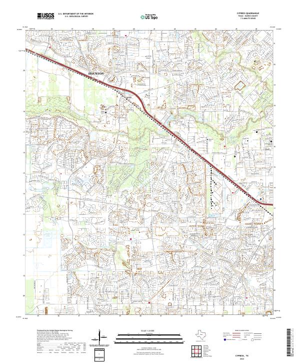
2022 Map of Cypress
USGS Topo · Published 2022About this map
Cypress sits at the heart of this suburban landscape, bisected by the heavy infrastructure of the NW Fwy and Hempstead Hwy. The area is defined by a dense network of residential developments and master-planned communities that have filled in the spaces between traditional prairie watercourses like Little Cypress Cr and Langham Cr. For local historians and genealogists, the map preserves the location of several smaller family burial grounds, including the Dolen Cem, Roeder Cem, and Hoffmeister Family Cem, which remain as vestiges of the area's rural past amidst modern expansion. Educational and community hubs such as Lone Star College - CyFair and Klein Memorial Park anchor the southern and eastern portions of the quadrangle, while the Dry Creek Airport serves as a distinct aviation landmark in the north.
Find a feature on this map
26 named features on this map. Tap any name to fly to it.
Don’t see what you’re looking for? This feature index may not catch every label — zoom into the map to look around manually.
Map Details
Editions of this 2022 Cypress Map
This is the sole edition of this map. No revisions or reprints were ever made.
Other maps of this area

1915 · Cypress
USGS Topo · 1:24,000

1915 · Katy
USGS Topo · 1:24,000

1915 · Addicks
USGS Topo · 1:24,000

1915 · Hillendahl
USGS Topo · 1:24,000

1916 · Rose Hill
USGS Topo · 1:24,000

1916 · Louetta
USGS Topo · 1:24,000

1916 · Hockley
USGS Topo · 1:24,000

1916 · Satsuma
USGS Topo · 1:24,000

1916 · Swanson
USGS Topo · 1:24,000

1918 · Cypress
USGS Topo · 1:31,680