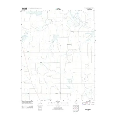
2012 Map of Dads Creek
USGS Topo · Published 2012About this map
The Washita River meanders across this Panhandle landscape, defining the hydrology of Hemphill County during this early 21st-century survey. A significant network of water management features, including Soil Conservation Service Site 8 Reservoir and Soil Conservation Service Site 23b Reservoir, dots the terrain, highlighting the region's focus on soil and water preservation. Local heritage is anchored at the Washita Cem near FM-277, while private aviation is represented by the Split B Ranch Airport and En Gedi Ranch Airport. The map traces the drainage patterns of numerous tributaries like Dads Cr, Threemile Cr, and Gageby Cr as they flow through a grid of county roads such as CO Road DD and Co RD-14.
Find a feature on this map
30 named features on this map. Tap any name to fly to it.
Don’t see what you’re looking for? This feature index may not catch every label — zoom into the map to look around manually.
Map Details
Editions of this 2012 Dads Creek Map
This is the sole edition of this map. No revisions or reprints were ever made.
Other maps of this area

1954 · Amarillo
USGS Topo · 1:250,000

1958 · Amarillo
USGS Topo · 1:250,000

1963 · Briscoe
USGS Topo · 1:24,000

1963 · Allison SW
USGS Topo · 1:24,000

1963 · Mobeetie
USGS Topo · 1:24,000

1967 · Mendota
USGS Topo · 1:24,000

1967 · Dads Creek
USGS Topo · 1:24,000

1967 · Lake June
USGS Topo · 1:24,000

1967 · Young Ranch
USGS Topo · 1:24,000

1967 · Blue Ridge School
USGS Topo · 1:24,000