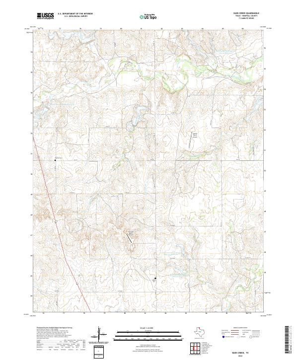
2022 Map of Dads Creek
USGS Topo · Published 2022About this map
The Washita River snakes across the northern portion of this Hemphill County landscape, defining a terrain of numerous creek drainages and ranching operations. The local history of this Texas Panhandle region is anchored by quiet landmarks like Washita Cem near the river and Gageby Cem further south. Scattered rural localities including Hobart and Fillingim are connected by a network of county roads and farm-to-market routes like FM 277. The importance of water management in this cattle-ranching country is evident through several reservoirs, such as Soil Conservation Service Site 8 Reservoir on White Creek. Aviation plays a role in modern ranching life here, noted by the presence of private airstrips like Split B Ranch Airport and En Gedi Ranch Airport. The topography is shaped by the constant carving of Dads Creek, Threemile Creek, and Major Cr.
Find a feature on this map
32 named features on this map. Tap any name to fly to it.
Don’t see what you’re looking for? This feature index may not catch every label — zoom into the map to look around manually.
Map Details
Editions of this 2022 Dads Creek Map
This is the sole edition of this map. No revisions or reprints were ever made.
Other maps of this area

1954 · Amarillo
USGS Topo · 1:250,000

1958 · Amarillo
USGS Topo · 1:250,000

1963 · Briscoe
USGS Topo · 1:24,000

1963 · Allison SW
USGS Topo · 1:24,000

1963 · Mobeetie
USGS Topo · 1:24,000

1967 · Mendota
USGS Topo · 1:24,000

1967 · Dads Creek
USGS Topo · 1:24,000

1967 · Lake June
USGS Topo · 1:24,000

1967 · Young Ranch
USGS Topo · 1:24,000

1967 · Blue Ridge School
USGS Topo · 1:24,000