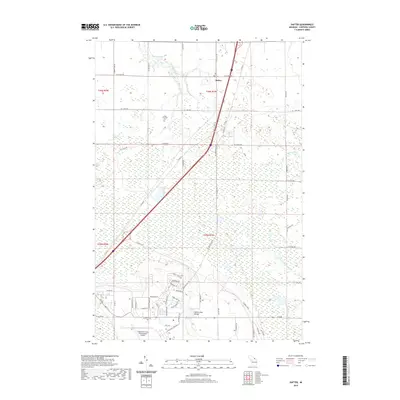
2019 Map of Dafter
USGS Topo · Published 2019About this map
Dafter serves as the central hub of this Upper Peninsula landscape, where agricultural grids intersect with the sprawling wetlands of the eastern Michigan interior. The 2019 survey documents a transition from the structured township blocks to the south, characterized by the residential layout near Chippewa County International Airport, to the more saturated terrain of the north. Significant local landmarks like the Dafter Township Cem and the leisure area at Dukes Lake Beach are clearly defined. The region's complex hydrology is a defining feature, with the headwaters and branches of several systems including the Charlotte River, the S Br Munuscong River, and the Little Munuscong River winding through the low-lying eastern sections. Notable water bodies such as Riordan Lake and Dukes Lake provide points of reference within the dense network of county roads and seasonal tracks.
Find a feature on this map
60 named features on this map. Tap any name to fly to it.
Don’t see what you’re looking for? This feature index may not catch every label — zoom into the map to look around manually.
Map Details
Editions of this 2019 Dafter Map
This is the sole edition of this map. No revisions or reprints were ever made.
Other maps of this area

1913 · Sault Sainte Marie
USGS Topo · 1:62,500

1941 · Sault Sainte Marie
USGS Topo · 1:63,360

1941 · Brimley
USGS Topo · 1:63,360

1951 · Shallows
USGS Topo · 1:24,000

1951 · Kinross
USGS Topo · 1:24,000

1951 · Dafter
USGS Topo · 1:24,000

1951 · Barbeau
USGS Topo · 1:24,000

1951 · Brimley
USGS Topo · 1:62,500

1951 · Sault Ste. Marie
USGS Topo · 1:62,500

1951 · Brimley
USGS Topo · 1:24,000