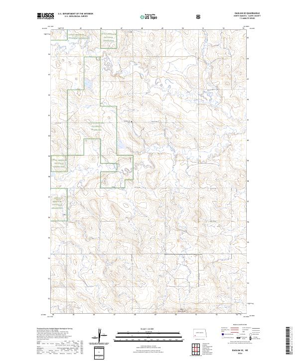
2024 Map of Daglum SE
USGS Topo · Published 2024About this map
The Little Missouri National Grassland dominates the western half of this Slope County terrain, where the headwaters of the Cannonball River begin their eastward journey. This high-plains landscape is characterized by a series of sections and townships, including t136n r99w and t135n r98w, marked by a network of straight-line section roads like 129th Ave SW and 57th St SW. Genealogy and local history researchers will find the Shöllsmade Cem situated along one of these corridors, providing a specific point of connection to the early families of the region. To the south, the prominent elevation of West Rainy Butte serves as a significant landmark above the surrounding prairie and drainages like Philbrick Creek.
Find a feature on this map
16 named features on this map. Tap any name to fly to it.
Don’t see what you’re looking for? This feature index may not catch every label — zoom into the map to look around manually.
Map Details
Editions of this 2024 Daglum SE Map
This is the sole edition of this map. No revisions or reprints were ever made.
Other maps of this area

1953 · Dickinson
USGS Topo · 1:250,000

1957 · Dickinson
USGS Topo · 1:250,000

1961 · Daglum
USGS Topo · 1:62,500

1973 · White Lake
USGS Topo · 1:24,000

1973 · New England NW
USGS Topo · 1:24,000

1973 · West Rainy Butte
USGS Topo · 1:24,000

1973 · East Rainy Butte
USGS Topo · 1:24,000

1973 · New England SW
USGS Topo · 1:24,000

1980 · Belfield
USGS Topo · 1:100,000

1980 · Mott
USGS Topo · 1:100,000