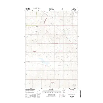
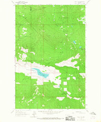
2014 Map of Dahl Lake
USGS Topo · Published 2014About this map
Pleasant Valley sits at the heart of this landscape, where the drainage of Pleasant Valley Cr and Elbow Cr converge near the waters of Dahl Lake. This 2014 survey reveals a region defined by its timber and watershed management, straddling the boundary between Kootenai National Forest and Flathead National Forest. The transition from the Lincoln and Flathead county line in the northwest toward the southern reaches near Little Bitterroot Lake illustrates the complex topography of the Salish Mountains. A network of Forest Service routes, such as Pleasant Valley Rd and NF-252, provides access to interior features like Lemonade Spring, indicating a land shaped by both natural hydrology and long-standing forestry infrastructure. The map provides a clear view of the mountain meadows and drainages that have sustained local ranching and logging interests for generations.
Find a feature on this map
21 named features on this map. Tap any name to fly to it.
Don’t see what you’re looking for? This feature index may not catch every label — zoom into the map to look around manually.
Map Details
Editions of this 2014 Dahl Lake Map
This is the sole edition of this map. No revisions or reprints were ever made.
Other maps of this area

1957 · Kalispell
USGS Topo · 1:250,000

1960 · Kalispell
USGS Topo · 1:250,000

1961 · Kalispell
USGS Topo · 1:250,000

1962 · Ashley Mountain
USGS Topo · 1:24,000

1963 · Sylvia Lake
USGS Topo · 1:24,000
1963 · Horse Hill
USGS Topo · 1:24,000

1964 · Meadow Peak
USGS Topo · 1:24,000
1964 · Pleasant Valley Mountain
USGS Topo · 1:24,000
1964 · Marion
USGS Topo · 1:24,000
1964 · Dahl Lake
USGS Topo · 1:24,000