
1963 Map of Sylvia Lake
USGS Topo · Published 1966About this map
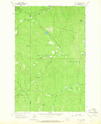
The Lincoln and Flathead county line runs directly through this high-elevation backcountry, dividing the mountainous terrain between Kootenai National Forest to the west and Flathead National Forest to the east. Surveyed in the early 1960s, the landscape is defined by a network of drainage basins, with waters flowing from the central Divide into systems like Sheppard Creek and Little Wolf Creek. The map reveals a wilderness largely accessible only by a primitive Pack Trail network, connecting high summits such as Mount Conner and Ingalls Mountain. The presence of Roadside Park near the namesake Sylvia Lake suggests a focused point of recreation amidst the steep topography. Notable for its hydrography, the area includes the headwaters of Hand Creek and the marshy expanses of Squaw Meadows, illustrating the complex watershed management of Montana’s national forests during the mid-century.
Find a feature on this map
19 named features on this map. Tap any name to fly to it.
Don’t see what you’re looking for? This feature index may not catch every label — zoom into the map to look around manually.
Map Details
Editions of this 1963 Sylvia Lake Map
3 editions found
Other maps of this area

1957 · Kalispell
USGS Topo · 1:250,000

1960 · Kalispell
USGS Topo · 1:250,000

1961 · Kalispell
USGS Topo · 1:250,000

1962 · Johnson Peak
USGS Topo · 1:24,000

1962 · Ashley Mountain
USGS Topo · 1:24,000
1963 · Bowen Lake
USGS Topo · 1:24,000
1963 · Dunsire Point
USGS Topo · 1:24,000
1963 · Horse Hill
USGS Topo · 1:24,000
1964 · Pleasant Valley Mountain
USGS Topo · 1:24,000
1964 · Dahl Lake
USGS Topo · 1:24,000