
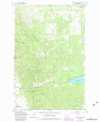
1964 Map of Meadow Peak
USGS Topo · Published 1967About this map
Kootenai National Forest dominates this mid-1960s landscape, where the high point of Meadow Peak serves as a primary geographic anchor. A Lookout Tower atop the peak suggests the active forest management and fire surveillance era of the mid-century. Below these heights, the Thompson River and McGregor Creek carve through the terrain, with Mc Gregor Lake visible in the southeastern corner.
Find a feature on this map
18 named features on this map. Tap any name to fly to it.
Don’t see what you’re looking for? This feature index may not catch every label — zoom into the map to look around manually.
Map Details
Editions of this 1964 Meadow Peak Map
2 editions found
Other maps of this area

1920 · Jennings
USGS Topo · 1:125,000

1935 · Thompson Lakes
USGS Topo · 1:96,000

1937 · Thompson Falls
USGS Topo · 1:125,000

1942 · Thompson Lakes
USGS Topo · 1:125,000

1956 · Wallace
USGS Topo · 1:250,000

1957 · Kalispell
USGS Topo · 1:250,000

1960 · Kalispell
USGS Topo · 1:250,000

1960 · Wallace
USGS Topo · 1:250,000

1961 · Kalispell
USGS Topo · 1:250,000
1964 · Shroder Creek
USGS Topo · 1:24,000