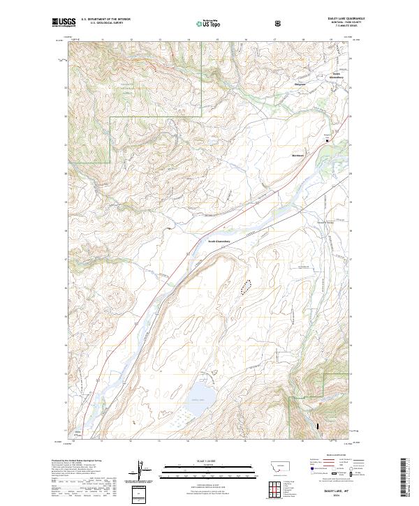
2024 Map of Dailey Lake
USGS Topo · Published 2024About this map
Paradise Valley serves as a corridor for the Yellowstone River, which anchors the settlements and transportation routes of this Park County landscape. In the late 19th and early 20th centuries, this reach of the river became a vital gateway for those traveling toward Yellowstone, a history evidenced by the Old Yellowstone Trl and the Point of Rocks landmark. The map illustrates a contemporary distribution of residential development in communities like Emigrant, North Glastonbury, and South Glastonbury, many of which feature road names like Capricorn Dr and Aries Dr. Genealogy interests are served by the location of Emigrant Cem near the river's bend. To the west, the terrain rises into the Gallatin National Forest, while the recreation-focused Dailey Lake and its associated Dailey Lake Campground lie in the southeastern portion of the quadrangle.
Find a feature on this map
89 named features on this map. Tap any name to fly to it.
Don’t see what you’re looking for? This feature index may not catch every label — zoom into the map to look around manually.
Map Details
Editions of this 2024 Dailey Lake Map
This is the sole edition of this map. No revisions or reprints were ever made.
Other maps of this area

1891 · Livingston
USGS Topo · 1:250,000

1893 · Livingston
USGS Topo · 1:250,000

1947 · Bozeman
USGS Topo · 1:250,000

1948 · Bozeman
USGS Topo · 1:250,000

1955 · Bozeman
USGS Topo · 1:250,000

1955 · Emigrant
USGS Topo · 1:62,500

1955 · Fridley Peak
USGS Topo · 1:62,500
1955 · Gardiner
USGS Topo · 1:62,500
1955 · Miner
USGS Topo · 1:62,500

1958 · Bozeman
USGS Topo · 1:250,000