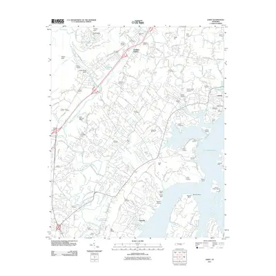
2011 Map of Daisy
USGS Topo · Published 2011About this map
Soddy-Daisy and the eastern suburbs of the Chattanooga area are defined by the extensive waters of Chickamauga Lake, where numerous points and islands like Dallas Island and John A Patten Island shape the residential and recreational landscape. The topography transitions from the low-lying lakefront up toward Grasshopper Hill and Flipper Bend in the west. This 2011 survey captures the area's modern residential density, particularly around Dallas Hollow and Lakesite, while preserving the locations of dozens of historical family burial grounds including the Poe, Shadwick, and Rawlston cemeteries.
Find a feature on this map
123 named features on this map. Tap any name to fly to it.
Don’t see what you’re looking for? This feature index may not catch every label — zoom into the map to look around manually.
Map Details
Editions of this 2011 Daisy Map
This is the sole edition of this map. No revisions or reprints were ever made.
Other maps of this area

1888 · Chattanooga
USGS Topo · 1:125,000

1893 · Chattanooga
USGS Topo · 1:125,000

1935 · East Chattanooga
USGS Topo · 1:24,000

1935 · Daisy
USGS Topo · 1:24,000

1935 · Soddy
USGS Topo · 1:24,000

1935 · Snow Hill
USGS Topo · 1:24,000

1935 · Ooltewah
USGS Topo · 1:24,000

1935 · Soddy Island
USGS Topo · 1:24,000

1936 · Henson Gap
USGS Topo · 1:24,000

1936 · Fairmount
USGS Topo · 1:24,000