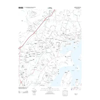
2013 Map of Daisy
USGS Topo · Published 2013About this map
Dallas Lake and its intricate shoreline dominate this Hamilton County landscape, where the waters of Dallas Bay and Harrison Bay reach into the suburban and residential developments north of Chattanooga. The map illustrates a high density of residential communities established by the early 21st century, including Sandalwood Village, Jeffery Acres, and Shannon Hills. These modern subdivisions are woven around older landmarks and physical geography such as Chickamauga Gulch and Flipper Bend.
Find a feature on this map
99 named features on this map. Tap any name to fly to it.
Don’t see what you’re looking for? This feature index may not catch every label — zoom into the map to look around manually.
Map Details
Editions of this 2013 Daisy Map
This is the sole edition of this map. No revisions or reprints were ever made.
Other maps of this area

1888 · Chattanooga
USGS Topo · 1:125,000

1893 · Chattanooga
USGS Topo · 1:125,000

1935 · East Chattanooga
USGS Topo · 1:24,000

1935 · Daisy
USGS Topo · 1:24,000

1935 · Soddy
USGS Topo · 1:24,000

1935 · Snow Hill
USGS Topo · 1:24,000

1935 · Ooltewah
USGS Topo · 1:24,000

1935 · Soddy Island
USGS Topo · 1:24,000

1936 · Henson Gap
USGS Topo · 1:24,000

1936 · Fairmount
USGS Topo · 1:24,000