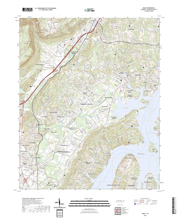
2022 Map of Daisy
USGS Topo · Published 2022About this map
Walden Ridge and the Cumberland Escarpment define the western geography of this Hamilton County landscape, where the high plateau drops sharply toward the suburban expansion of northern Chattanooga. The map documents a dense network of residential developments and historical family sites, particularly concentrated around Soddy-Daisy and Middle Valley. The eastern portion is dominated by the complex shoreline of the Tennessee River, featuring Harrison Bay and numerous named points and islands like Waconda Point and John A Patten Island. For genealogists, the map is remarkably detailed, identifying over a dozen small burial grounds including the Ephraim Hixson Cem, Stony Point Cem, and Foster Hixson Cem. These family-named landmarks, alongside older transport routes like Dayton Pike, provide a clear record of how early settlement patterns were integrated into the modern suburban fabric.
Find a feature on this map
96 named features on this map. Tap any name to fly to it.
Don’t see what you’re looking for? This feature index may not catch every label — zoom into the map to look around manually.
Map Details
Editions of this 2022 Daisy Map
This is the sole edition of this map. No revisions or reprints were ever made.
Other maps of this area

1888 · Chattanooga
USGS Topo · 1:125,000

1893 · Chattanooga
USGS Topo · 1:125,000

1935 · East Chattanooga
USGS Topo · 1:24,000

1935 · Daisy
USGS Topo · 1:24,000

1935 · Soddy
USGS Topo · 1:24,000

1935 · Snow Hill
USGS Topo · 1:24,000

1935 · Ooltewah
USGS Topo · 1:24,000

1935 · Soddy Island
USGS Topo · 1:24,000

1936 · Henson Gap
USGS Topo · 1:24,000

1936 · Fairmount
USGS Topo · 1:24,000