
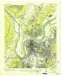
1935 Map of Daisy
USGS Topo · Published 1935About this map
The Tennessee River divides this 1935 landscape, flowing past Harrison Bluff and Dallas Island before the construction of major dams permanently altered the local hydrology. Near Daisy, an industrial pocket is defined by Brick Kilns and a Clay Pit connected by a Conveyor, highlighting the area's early extractive economy. Along the Southern Railway and North Chickamauga Creek, the terrain transitions from the heights of Walden Ridge and the Cumberland Escarpment down to the fertile river bottoms. Local life is documented through a dense network of country landmarks, including Hixson Mill, the Harrison Ferry, and numerous family-named burial grounds like Poe Cem and Smith Cem. Educational and social hubs are well-marked, from Camp Tsatanugi to schools like Ganns Sch and Miller Grove Sch, providing a clear record of rural Hamilton County communities during the mid-1930s.
Find a feature on this map
69 named features on this map. Tap any name to fly to it.
Don’t see what you’re looking for? This feature index may not catch every label — zoom into the map to look around manually.
Map Details
Editions of this 1935 Daisy Map
This is the sole edition of this map. No revisions or reprints were ever made.
Other maps of this area

1888 · Chattanooga
USGS Topo · 1:125,000

1893 · Chattanooga
USGS Topo · 1:125,000

1935 · East Chattanooga
USGS Topo · 1:24,000

1935 · Soddy
USGS Topo · 1:24,000

1935 · Snow Hill
USGS Topo · 1:24,000

1935 · Ooltewah
USGS Topo · 1:24,000

1935 · Soddy Island
USGS Topo · 1:24,000

1936 · Henson Gap
USGS Topo · 1:24,000

1936 · Fairmount
USGS Topo · 1:24,000
1936 · Chattanooga
USGS Topo · 1:24,000