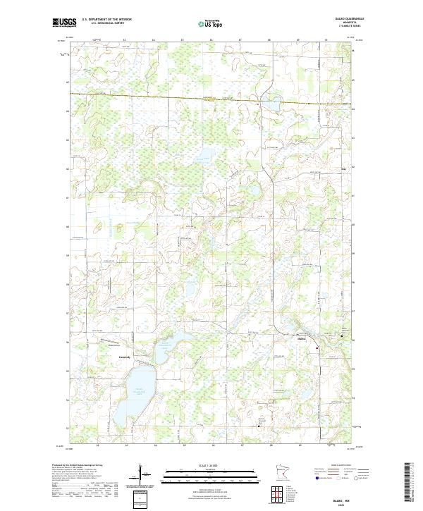
2022 Map of Dalbo
USGS Topo · Published 2022About this map
Dalbo and Day anchor this portion of the northern Minnesota landscape, where the transition between cultivated fields and extensive wetlands is sharply defined. The terrain is characterized by a high concentration of glacial depressions, including the substantial Odegard Bog and Krone Bog, which feed into local waterways like Washburn Brook and Stanchfield Cr. Small-scale aviation and agriculture coexist here, evidenced by the Pfau Airstrip located just north of the Carmody settlement area. Genealogy and local history are preserved at sites like the Salem Lutheran Cem near Dalbo and the Karmel Covenant Cem to the south. The hydrography is dominated by the connected basins of North Stanchfield Lake and South Stanchfield Lake, which illustrate the complex drainage patterns of the Isanti County region during the early twenty-first century.
Find a feature on this map
61 named features on this map. Tap any name to fly to it.
Don’t see what you’re looking for? This feature index may not catch every label — zoom into the map to look around manually.
Map Details
Editions of this 2022 Dalbo Map
This is the sole edition of this map. No revisions or reprints were ever made.
Other maps of this area

1953 · Stillwater
USGS Topo · 1:250,000

1955 · Stillwater
USGS Topo · 1:250,000

1958 · Stillwater
USGS Topo · 1:250,000

1961 · Bradford
USGS Topo · 1:24,000

1961 · Springvale
USGS Topo · 1:24,000

1961 · Dalbo
USGS Topo · 1:24,000

1961 · Wyanett
USGS Topo · 1:24,000

1961 · Dalbo
USGS Topo · 1:62,500

1965 · Stillwater
USGS Topo · 1:250,000
1968 · Princeton
USGS Topo · 1:24,000