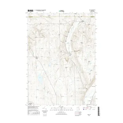
2016 Map of Dale
USGS Topo · Published 2016About this map
Attica Center and Orangeville Center anchor the western portion of this landscape, where the headwaters of Stony Brook and Wards Brook have carved deep local depressions known as gulfs. The terrain is defined by a series of prominent elevations like Colton Hill and Wheelers Hill, which separate the agricultural plateaus from the Wyoming Valley in the southeast. Numerous small cemeteries, including Dale Pioneer Cem and Carlton Hill Cem, are scattered throughout the rural landscape, offering valuable points of reference for genealogists tracking early families in Wyoming County. The inclusion of the Attica Reservoir and several named swamps like Bannan Swamp indicates a complex hydrological system that feeds into the Oatka Creek drainage. The map's grid of rural roads, such as Co Rd 15 and Molasses Hill Rd, connects these isolated settlements and family burial grounds across the rolling New York uplands.
Find a feature on this map
89 named features on this map. Tap any name to fly to it.
Don’t see what you’re looking for? This feature index may not catch every label — zoom into the map to look around manually.
Map Details
Editions of this 2016 Dale Map
This is the sole edition of this map. No revisions or reprints were ever made.
Other maps of this area

1904 · Batavia
USGS Topo · 1:62,500

1905 · Attica
USGS Topo · 1:62,500

1905 · Portage
USGS Topo · 1:62,500

1923 · Arcade
USGS Topo · 1:62,500

1925 · Arcade
USGS Topo · 1:62,500

1943 · Warsaw
USGS Topo · 1:24,000

1943 · Castile
USGS Topo · 1:24,000

1944 · Alexander
USGS Topo · 1:31,680

1944 · Stafford
USGS Topo · 1:31,680

1944 · Warsaw
USGS Topo · 1:31,680