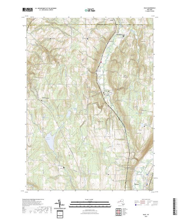
2023 Map of Dale
USGS Topo · Published 2023About this map
Linden and West Middlebury anchor the high ground of Wyoming County, where the terrain is carved by deeply incised drainage features such as Kennedy Gulf, Ewell Gulf, and Dusing Gulf. This modern landscape maintains its agricultural character, evidenced by the numerous cemeteries including Vernal Cem and the Dale Pioneer Cem that serve as vital links for family history researchers. The central portion of the map is dominated by a complex network of wetlands, such as Webbers Swamp and Bannan Swamp, which drain into the Attica Reservoir. Transport in the region is defined by the Norfolk Southern rail line and a grid of rural roads like Blackhouse Rd and Halls Corners Rd, connecting small settlements like Dale and Attica Center to the larger seat of Warsaw at the southern edge.
Find a feature on this map
98 named features on this map. Tap any name to fly to it.
Don’t see what you’re looking for? This feature index may not catch every label — zoom into the map to look around manually.
Map Details
Editions of this 2023 Dale Map
This is the sole edition of this map. No revisions or reprints were ever made.
Other maps of this area

1904 · Batavia
USGS Topo · 1:62,500

1905 · Attica
USGS Topo · 1:62,500

1905 · Portage
USGS Topo · 1:62,500

1923 · Arcade
USGS Topo · 1:62,500

1925 · Arcade
USGS Topo · 1:62,500

1943 · Warsaw
USGS Topo · 1:24,000

1943 · Castile
USGS Topo · 1:24,000

1944 · Alexander
USGS Topo · 1:31,680

1944 · Stafford
USGS Topo · 1:31,680

1944 · Warsaw
USGS Topo · 1:31,680