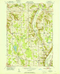
1951 Map of Dale
USGS Topo · Published 1951About this map
Tonawanda Creek carves a deep valley through this 1951 Wyoming County landscape, where the Erie RR and Baltimore and Ohio RR follow the contours of the drainage. The map captures a transition between rural agriculture and industrial infrastructure, evidenced by the large Attica Reservoir and the Television Tower standing on a high ridge. A high concentration of family-named crossroads and small settlements like Vernal Corners, Eastman Corners, and Sickleys Corners define the township boundaries of Attica, Middlebury, and Orangeville.
Find a feature on this map
85 named features on this map. Tap any name to fly to it.
Don’t see what you’re looking for? This feature index may not catch every label — zoom into the map to look around manually.
Map Details
Editions of this 1951 Dale Map
This is the sole edition of this map. No revisions or reprints were ever made.
Other maps of this area

1904 · Batavia
USGS Topo · 1:62,500

1905 · Attica
USGS Topo · 1:62,500

1905 · Portage
USGS Topo · 1:62,500

1923 · Arcade
USGS Topo · 1:62,500

1925 · Arcade
USGS Topo · 1:62,500

1943 · Warsaw
USGS Topo · 1:24,000

1943 · Castile
USGS Topo · 1:24,000

1944 · Alexander
USGS Topo · 1:31,680

1944 · Stafford
USGS Topo · 1:31,680

1944 · Warsaw
USGS Topo · 1:31,680